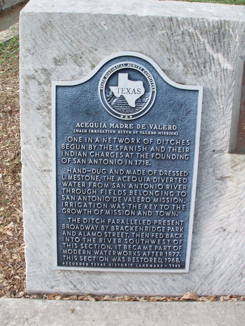
Acequia Madre De Valero
(Main Entrance Ditch of Valero Mission )
|
B
E X A R C O U N T Y |
Marker No: 78
Aluminum 18 x 28 Subject Marker
Texas Historic Landmark
Geographic: 29.419640,-98.486801
|
Marker Text: One in a network of ditches begun by Spanish and their Indian charges at the founding of San Antonio in 1718.
Hand-dug and made of dressed limestone, the acequia diverted water from San Antonio River through fields belonging to San Antonio De Valero Mission. Irrigation was the key to the growth of mission and town. The ditch paralleled present broadway by Brackenridge Park and Alamo Street, then fed back into the river southwest of this section. It became part of modern waterworks after 1877. This section was restored, 1968. (1968) Location: Hemisfair Plaza, South Alamo Street, San Antonio
|