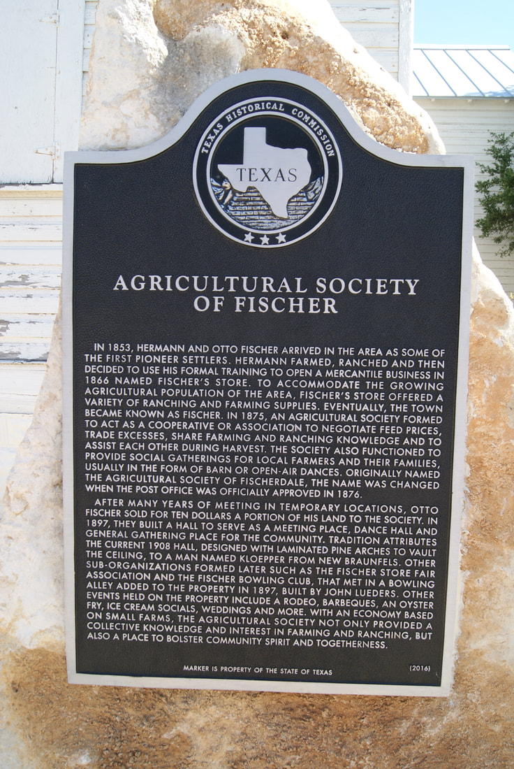
Agricultural Society
of Fischer
|
C
O M A L C O U N T Y |
Marker No: 18454
Aluminum 27 x 42 Subject Marker
Geographic: 29.981216, -98.254173
Location: 701 Fischer Store Road, Fischer
|
Marker Text: In 1853, Hermann and Otto Fischer arrived in the area as some of the first pioneer settlers. Hermann farmed, ranched and then decided to use his formal training to open a mercantile business in 1866 named Fischer's Store. To accommodate the growing agricultural population of the area, Fischer's Store offered a variety of ranching and farming supplies. Eventually, the town became known as Fischer. In 1875, an agricultural society formed to act as a cooperative or association to negotiate feed prices, trade excesses, share farming and ranching knowledge and to assist each other during harvest. The society also functioned to provide social gatherings for local farmers and their families, usually in the form of barn or open-air dances. Originally named the Agricultural Society of Fischerdale, the name was changed when the post office was officially approved in 1876. After many years of meeting in temporary locations, Otto Fischer sold for ten dollars a portion of his land to the Society. In 1897, they built a hall to serve as a meeting place, dance hall and general gathering place for the community. Tradition attributes the current 1908 hall, designed with laminated pine arches to vault the ceiling, to a man named Kloepper from New Braunfels. Other sub-organizations formed later such as the Fischer Store Fair Association and the Fischer Bowling Club, that met in a bowling alley added to the property in 1897, built by John Lueders. Other events held on the property include a rodeo, barbeques, an oyster fry, ice cream socials, weddings and more. With an economy based on small farms, the Agricultural Society not only provided a collective knowledge and interest in farming and ranching, but also a place to bolster community spirit and togetherness. (2016)
|