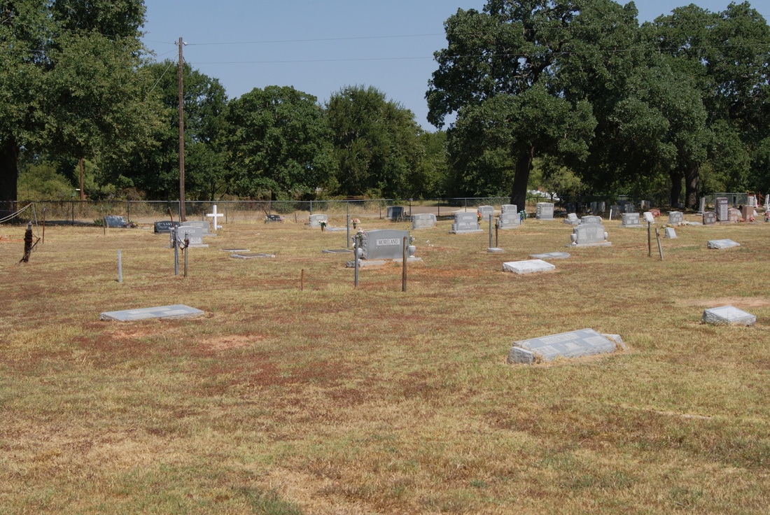
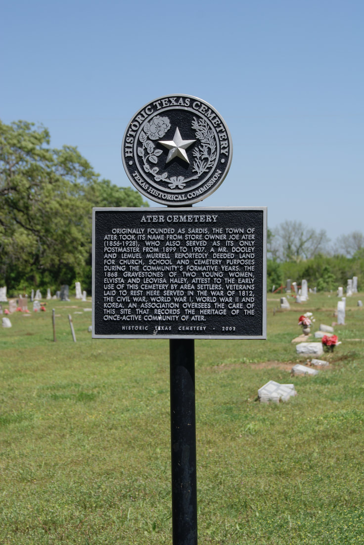
Ater Cemetery
|
C
O R Y E L L C O U N T Y |
Location: from Gatesville, go 1 mile west on US 84, turn right on FM 2412; after approximately 10 mi. turn right on CR 174 and go north on winding paved road 1.8 miles to cemetery
|
Marker Text: Originally founded as Sardis, the town of Ater took its name from store owner Joe Ater (1856-1928), who also served as its only postmaster from 1899 to 1907. A Mr. Dooley and Lemuel Murrell reportedly deeded land for church, school and cemetery purposes during the community's formative years. The 1868 gravestones of two young women, Elvista and Leovisa Haley, attest to the early use of this cemetery by area settlers. Veterans laid to rest here served in the War of 1812, the Civil War, World War I, World War II and Korea. An association oversees the care of this site that records the heritage of the once-active community of Ater. (2002)
Marker No: 15323
Texas Historical Cemetery Marker
Geographic: 31.521605,-97.860367
|