Bluff Dale Suspension Bridge
|
E
R A T H C O U N T Y |
Marker No: 441
Aluminum 18 x 28 Subject Marker
National Register of Historic Places
Geographic: 32.353672,-98.025528
|
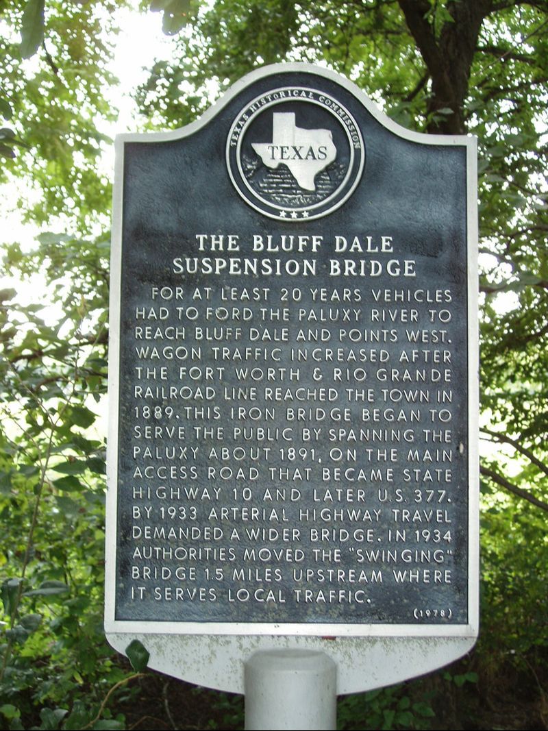
Marker Text: For at least 20 years vehicles had to ford the Paluxy River to reach Bluff Dale and points west. Wagon traffic increased after the Fort Worth & Rio Grande Railroad line reached the town in 1889. This iron bridge began to serve the public by spanning the Paluxy about 1891, on the main access road that became State Highway 10 and later U.S. 377. By 1933 arterial highway travel demanded a wider bridge. In 1934 authorities moved the "swinging" bridge 1.5 miles upstream where it serves local traffic. (1978)
Location: Berry Creek Road, CR 49, 0.25 miles north of US 377, Bluff Dale
|