• Alfred M. Hallmark
  • First Baptist Church of Zephyr
  • Military Road
  • Belle Plaine Cemetery
  • Community of Fodice
  • Providence Church and Cemetery
  • Packsaddle Mountain
  • No. 59 Old San Antonio Road
  • Anderson County in the Civil War
  • Smithfield Baptist Church
  • Phair Cemetery
  • New Page
  • New Page
  • New Page
TEXAS HISTORICAL MARKERS

Cameron County

​C
A
M
E
R
O
N

C
O
U
N
T
​Y
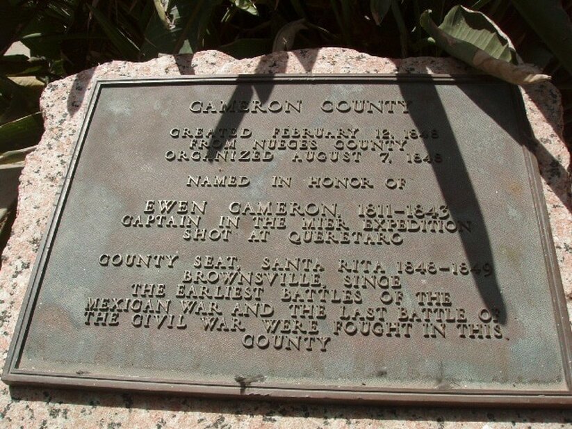
Marker Text: Created February 21, 1848; From Nueces County; Organized August 7, 1848; Named in honor of Ewen Cameron, 1811-1843; Captain in the Mier Expedition; Shot at Queretaro; County Seat, Santa Rita 1848-1849; Brownsville, since the earliest battles of the Mexican War, and the last battle of the Civil War were fought in this county (1936) 
Marker No: 639
Pink Granite 1936 County Centennial Marker
Geographic: 25.949860,-97.506157
Location:Brownsville Tourist Center, corner of FM 802 and U.S. Highway 77, Brownsville.
Picture
Proudly powered by Weebly
  • Alfred M. Hallmark
  • First Baptist Church of Zephyr
  • Military Road
  • Belle Plaine Cemetery
  • Community of Fodice
  • Providence Church and Cemetery
  • Packsaddle Mountain
  • No. 59 Old San Antonio Road
  • Anderson County in the Civil War
  • Smithfield Baptist Church
  • Phair Cemetery
  • New Page
  • New Page
  • New Page