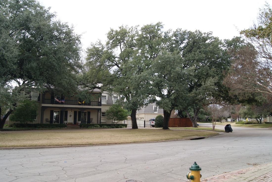
Castle Heights
|
M
C L E N N A N C O U N T Y |
Marker Text: This historic Waco neighborhood exhibits distinctive design features. W.T. Herrick and W.L. Wollett platted Castle Heights in 1923, naming it for nearby Cottonland Castle and its elevation above the commercial district. Notable elements included curved streets, traffic circles, and excellent local examples of architectural revival styles such as Tudor, Colonial, Georgian, Classical and Mediterranean. For six years Castle Heights was an independent village, voting to incorporate in Sept. 1939; the City of Waco annexed the area in Dec. 1945. The cohesive collection of early and mid-Twentieth Century homes reflects a break with the existing urban grid, and links Castle Heights to national trends of suburban planning and development. (2008)
Marker No: 14408
Aluminum 18 x 28 Subject Marker
National Register of Historic Places
Location: Central Place, Chateau Avenue & Carondolet Boulevard, Waco
|
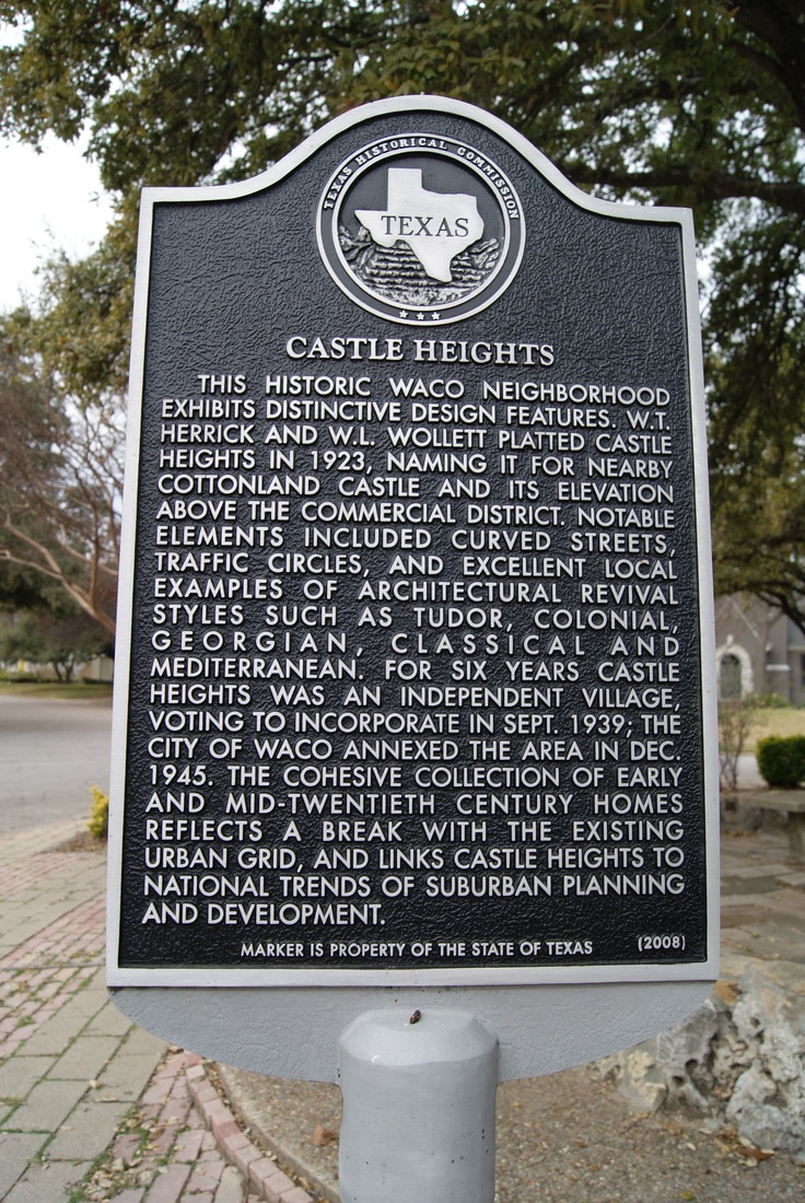
Geographic: 31.532885,-97.160957
|