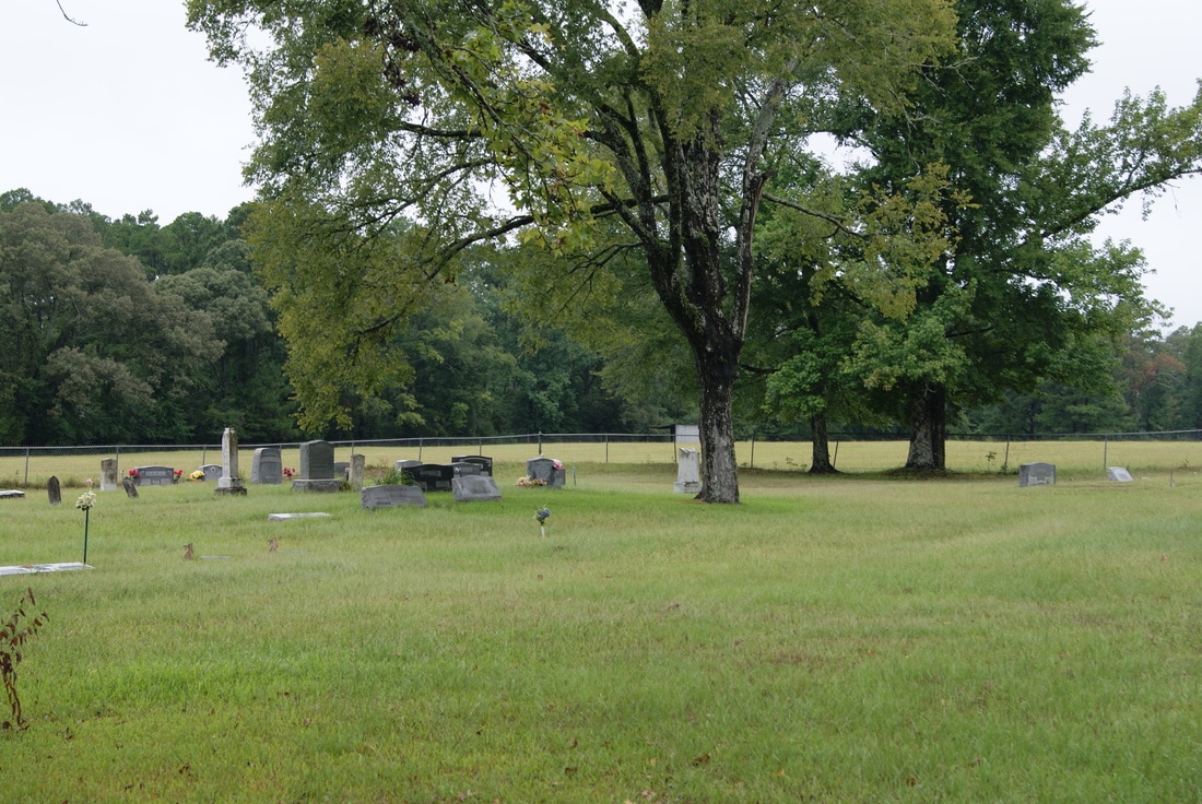
Cedar Point Church and Cemetery
|
H
O U S T O N C O U N T Y |
Marker Text: Formal organization of the Cedar Point Church occurred in July 1885, shortly after a church building was constructed at this site. Led by Presbyterian circuit preachers, the congregation placed emphasis on Christian education, music, and revivals until a declining membership led to dissolution about 1946. Within a few years of its organization, the Cedar Point Church began the adjacent cemetery in which the first marked grave, that of Sam Houston Rice, dates to 1891. A cemetery association, formed after the church disbanded, has maintained the grounds over the years. (1986)
Marker No: 11083
Aluminum 18 x 28 Subject Marker
Geographic: 31.435381,-95.246407
|
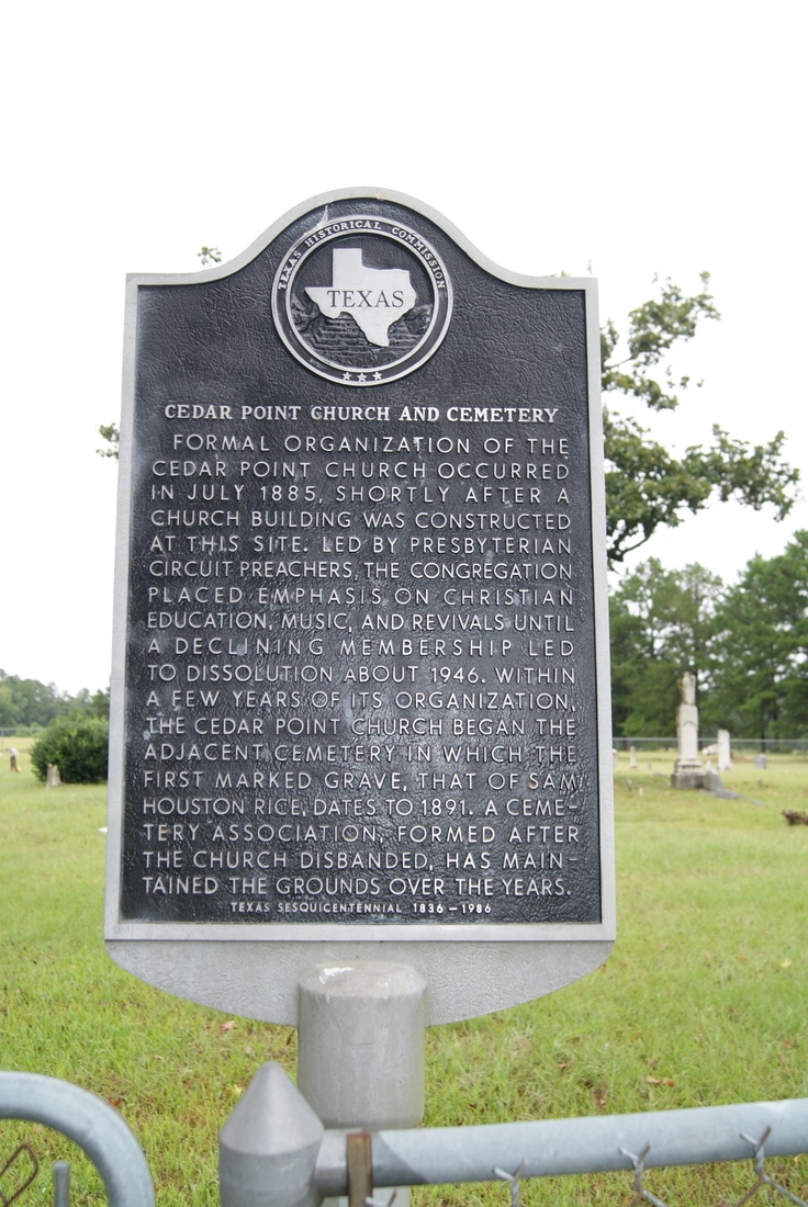
Location: 12 miles northeast for Crockett on SH 21, then 5 miles south on FM 1733, then on CR 1125 for .75 mile
|