Comal County
|
C
O M A L C O U N T Y |
|
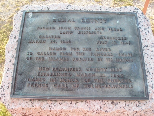
Marker Text: Formed from Travis and Bexar land districts.
Created - March 24, 1846; Organized - July-13, 1846;
Named for the river, so called from the pancake shape of the islands formed by its springs.
New Braunfels, county seat establshed March 21,1845. Named in honor of the founder Prince Carl of Solms-Braunfels. (1936)
Created - March 24, 1846; Organized - July-13, 1846;
Named for the river, so called from the pancake shape of the islands formed by its springs.
New Braunfels, county seat establshed March 21,1845. Named in honor of the founder Prince Carl of Solms-Braunfels. (1936)
Marker No: 986
Pink Granite 1936 County Centennial Marker
Geographic: 29.703667,-98.095833
Location: On Business IH 35, just north of intersection with SH 46, New Braunfels - (1 mile north of New Braunfels, US 81)