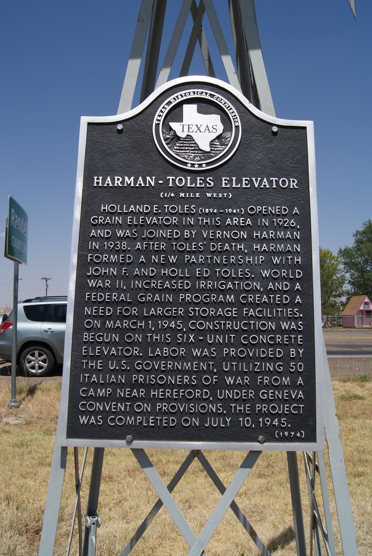
Harman-Toles Elevator (1/4 Mile West)
|
Marker Text: Holland E. Toles (1894-1941) opened a grain elevator in this area in 1926, and was joined by Vernon Harman in 1938. After Toles' death, Harman formed a new partnership with John F. and Holl Ed Toles. World War II, increased irrigation, and a federal grain program created a need for larger storage facilities. On March 1, 1945, construction was begun on this six-unit concrete elevator. Labor was provided by the U.S. government, utilizing 50 Italian prisoners of war from a camp near Hereford, under Geneva Convention provisions. The project was completed on July 10, 1945. (1974)
Marker No: 2383
Aluminum 18 x 28 Subject Marker
Geographic: 34° 44.892′ N, 101° 51.219′ W
Location: U.S. 87 south of West Happy West Road, Happy
|