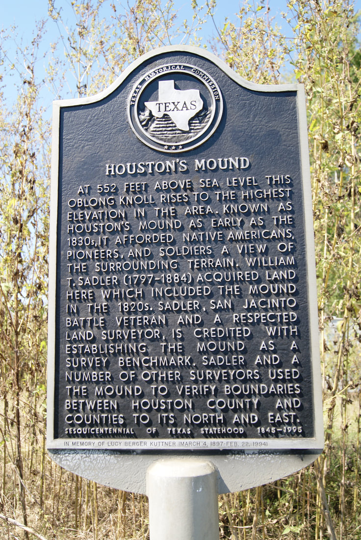
• Alfred M. Hallmark
  • First Baptist Church of Zephyr
  • Military Road
  • Belle Plaine Cemetery
  • Community of Fodice
  • Providence Church and Cemetery
  • Packsaddle Mountain
  • No. 59 Old San Antonio Road
  • Anderson County in the Civil War
  • Smithfield Baptist Church
  • Phair Cemetery
  • New Page
  • New Page
  • New Page
TEXAS HISTORICAL MARKERS

​Houston's Mound

​H
O
U
S
T
O
N

C
O
U
N
T
​Y
Marker Text: ​At 552 feet above sea level this oblong knoll rises to the highest elevation in the area. Known as Houston's Mound as early as the 1830s, it afforded Native Americans, pioneers, and soldiers a view of the surrounding terrain. William T. Sadler (1797-1884) acquired land here which included the mound in the 1820s. Sadler, San Jacinto battle veteran and a respected land surveyor, is credited with establishing the mound as a survey benchmark. Sadler and a number of other surveyors used the mound to verify boundaries between Houston County and counties to its north and east. (1995) 
Marker No: 14051
Aluminum 18 x 28 Subject Marker
Geographic: 31.575415,-95.406593
Picture
Location: ​20 miles north of Crockett on FM 2022
Proudly powered by Weebly
  • Alfred M. Hallmark
  • First Baptist Church of Zephyr
  • Military Road
  • Belle Plaine Cemetery
  • Community of Fodice
  • Providence Church and Cemetery
  • Packsaddle Mountain
  • No. 59 Old San Antonio Road
  • Anderson County in the Civil War
  • Smithfield Baptist Church
  • Phair Cemetery
  • New Page
  • New Page
  • New Page