• Alfred M. Hallmark
  • First Baptist Church of Zephyr
  • Military Road
  • Belle Plaine Cemetery
  • Community of Fodice
  • Providence Church and Cemetery
  • Packsaddle Mountain
  • No. 59 Old San Antonio Road
  • Anderson County in the Civil War
  • Smithfield Baptist Church
  • Phair Cemetery
  • New Page
  • New Page
  • New Page
TEXAS HISTORICAL MARKERS

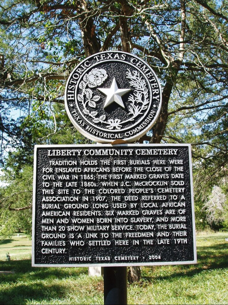
​Liberty Community Cemetery

​W
A
S
H
I
N
G
T
O
N

C
O
U
N
T
​Y
Marker Text: ​Tradition holds the first burials here were for enslaved Africans before the close of the Civil War in 1865; the first marked graves date to the late 1860s. When J.C. McCrocklin sold this site to the Colored People's Cemetery Association in 1907, the deed referred to a burial ground long used by local African American residents. Six marked graves are of men and women born into slavery, and more than 20 show military service. Today, the burial ground is a link to the Freedmen and their families who settled here in the late 19th century. (2004)
Marker No: 13241
Texas Historical Cemetery Marker
Picture
Geographic: 30.328295, -96.361237
Location: northwest of Independence; from intersection of McCrocklin and Coles roads, travel approximately 0.4 mile west on Coles Road, then turn right on unmarked road.
Proudly powered by Weebly
  • Alfred M. Hallmark
  • First Baptist Church of Zephyr
  • Military Road
  • Belle Plaine Cemetery
  • Community of Fodice
  • Providence Church and Cemetery
  • Packsaddle Mountain
  • No. 59 Old San Antonio Road
  • Anderson County in the Civil War
  • Smithfield Baptist Church
  • Phair Cemetery
  • New Page
  • New Page
  • New Page