Mason County
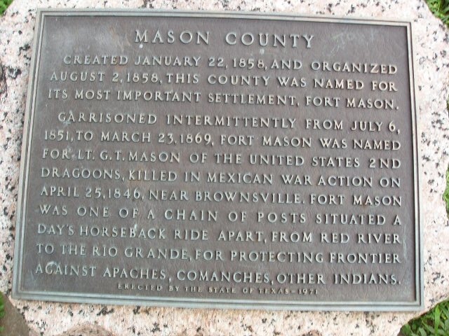
Marker Text: Created January 22, 1858, and organized August 2, 1858, this county was named for its most important settlement, Fort Mason. Garrisoned intermittently from July 6, 1851, to March 23, 1869, Fort Mason was named for Lt. G. T. Mason of the United States 2nd Dragoons, killed in Mexican War action on April 25, 1846, near Brownsville. Fort Mason was one of a chain of posts situated a day's horseback ride apart, from Red River to the Rio Grande, for protecting frontier against Apaches, Comanches, other Indians. (1936) (1971)
Marker No: 11285
Pink Granite 1936 County Centennial Marker
Geographic: 30.73538,-99.216698
Location: From Mason take U.S. Highway 87 south approximately 2 miles to rest stop (across U. S. Highway 87 from Fort Mason City Park)