Mayberry Park Cemetery
|
B
E L L C O U N T Y |
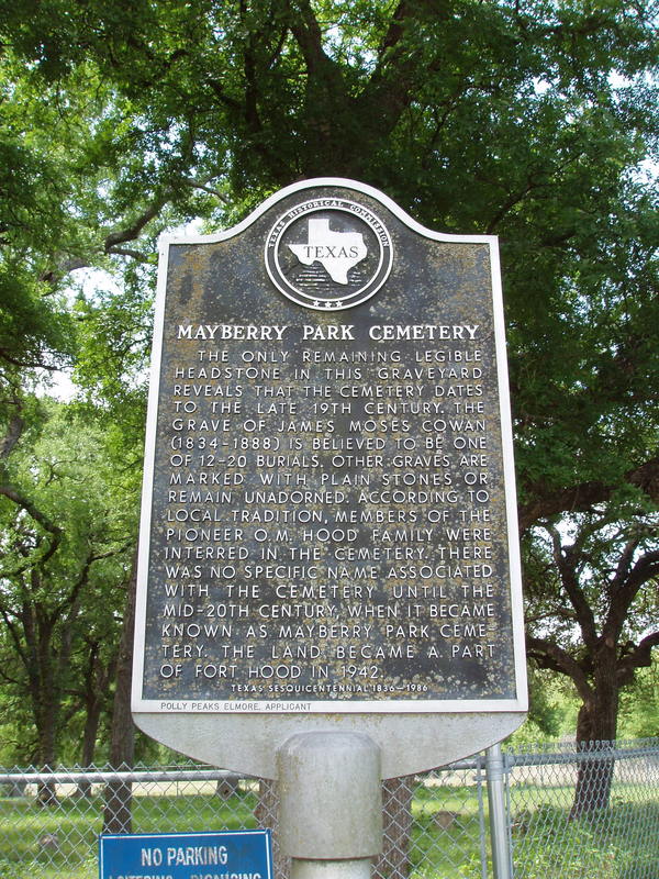
Marker No: 3267
Aluminum 18 x 28 Subject Marker
Geographic: 31.037937, -97.807686
Location: Off Maxdale Road, along Reese Creek, just inside the southeast boundary of Ft. Hood, Killeen
|
Marker Text: The only remaining legible headstone in this graveyard reveals that the cemetery dates to the late 19th century. The grave of James Moses Cowan (1834-1888) is believed to be one of 12-20 burials. Other graves are marked with plain stones or remain unadorned. According to local tradition, members of the pioneer O.M. Hood family were interred in the cemetery. There was no specific name associated with the cemetery until the mid-20th century, when it became known as Mayberry Park Cemetery. The land became a part of Fort Hood in 1942. (1986)
|