Moffatt
|
B
E L L C O U N T Y |
Geographic: 31.199743, -97.467545
Location: From Temple, take FM 36 northwest about 10 miles north to Moffat Road. Follow Moffat Road about 1.5 miles to First Baptist Church, Moffat.
|
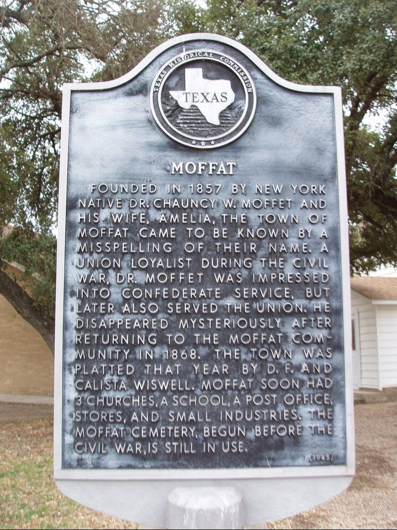
Marker Text: Founded in 1857 by New York native Dr. Chauncy M. Moffet and his wife, Amelia, the town of Moffat came to be known by a misspelling of their name. A Union loyalist during the Civil War, Dr. Moffet was impressed into Confederate service, but later also served the Union. He disappeared mysteriously after returning to the Moffat community in 1868. The town was platted that year by D.F. and Calista Wiswell. Moffat soon had 3 churches, a school, a post office, stores, and small industries. The Moffat Cemetery, begun before the Civil War, is still in use. (1985)
Marker No: 3431
Aluminum 18 x 28 Subject Marker
|