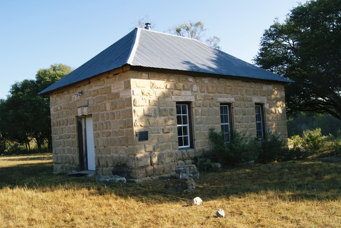
Old Noxville School
|
K
I M B L E C O U N T Y |
Marker Text: Erected about 1880. Used as a school until the district was consolidated with Harper, 1940.
Native limestone was quarried nearby, laid by local people including Noah Nox (who founded Noxville), Will Lennon, Lafayette McDonald, J. H. Parker and sons. Nearby (about 300 yds. W) were a post office and store, run by Nox and wife. Building now serves as a polling place for Precinct 4. Noxville cemetery is located across the creek (600 yds. NE). (1968) Medallion & Plate
Geographic: 30° 23' 23.676" N, 99° 28' 2.208" W
|
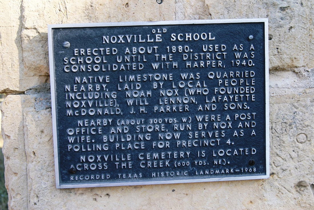
Marker No: 3816
Texas Historic Landamrk
Location: 29 miles east of Junction Via FM 479 on CR just east of little Devil's River; school is about 1/2 down CR.
|