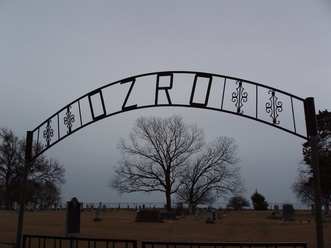
Orzo Cemetery
|
E
L L I S C O U N T Y |
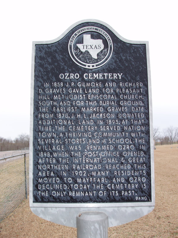
Marker Text: In 1858 J.P. Gilmore and Richard D. Graves gave land for Pleasant Hill Methodist Episcopal Church, south, and for this burial ground. The earliest marked graves date from 1870. J.H.L. Jackson donated additional land in 1895. At that time, the cemetery served Nation Town, a thriving community with several stores and a school. The village was renamed Ozro in 1898, when that post office opened. After the International & Great Northern Railroad reached this area in 1902, many residents moved to Maypearl, and Ozro declined. Today the cemetery is the only remnant of its past. (1978)
Marker No: 7136
Aluminum 18 x 28 Subject Marker
|
Geographic: 32.335583, -97.055038
Location: Intersection of Orzo Road and Smith Road 1 mile off FM 157, 3 mile north of Maypearl
|