Palo Pinto County
|
P
A L O P I N T O C O U N T Y |
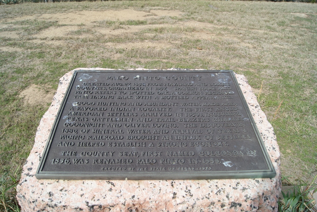
Marker Text: Created August 27, 1856, from Navarro and Bosque counties; organized in 1857. Spanish name Palo Pinto refers to spotted oak, a common regional tree having bark with a mottled appearance. Good hunting and abundant water made area a favored indian locality. The first anglo-american settlers arrived in 1850's, including Texas cattlemen and trail-blazers Charles Goodnight and Oliver Loving. The discovery, in 1880, of mineral water and arrival of Texas & Pacific railroad brought an influx of settlers and helped establish a strong economy. The county seat, first named Golconda in 1856, was renamed Palo Pinto in 1858. (1936) (1973)
Marker No: 3920
1936 Pink Granite Centennial County Marker
Geographic: 32.763172,-98.325653
Location: 1.25 miles west of Palo Pinto on Highway 180
|