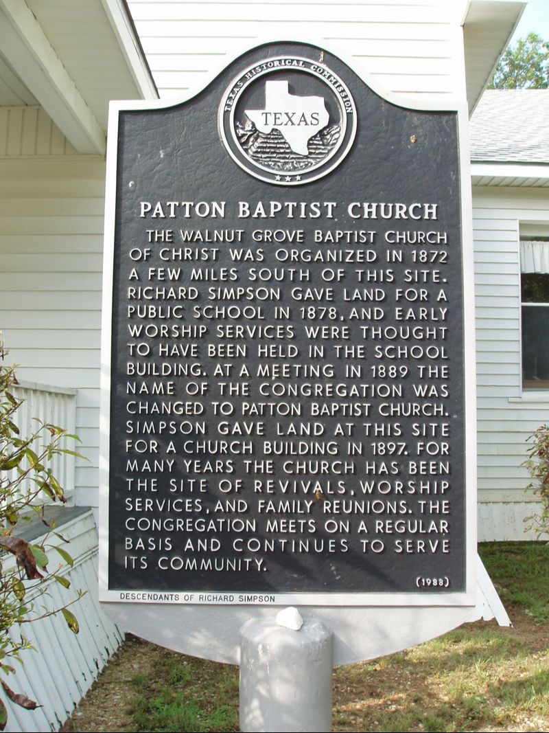
Patton Baptist Church
|
M
C L E N N A N C O U N T Y |
Marker No: 3954
Aluminum 18 x 28 Subject Marker
Geographic: 31.614416, -97.457115
|
Marker Text: The Walnut Grove Baptist Church of Christ was organized in 1872 a few miles south of this site. Richard Simpson gave land for a public school in 1878, and early worship services were thought to have been held in the school building. At a meeting in 1889 the name of the congregation was changed to Patton Baptist Church. Simpson gave land at this site for a church building in 1897. For many years the church has been the site of revivals, worship services, and family reunions. The congregation meets on a regular basis and continues to serve its community. (1988)
Location: From Crawford take 317 north 8 miles to Old Patton Road, to west to Patton Community
|