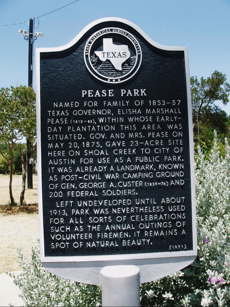
Pease Park
|
T
R A V I S C O U N T Y |
Marker No: 15397
Aluminum 18 x 28 Subject Marker
State Antiquities Landmark
Geographic: 30.280966, -97.751480
Location: Pease Park, Kingsbury Street at Parkway, Austin
|
Marker Text: Named for family of 1853-57 Texas Governor Elisha Marshall Pease (1812-83), within whose Early-Day plantation this area was situated. Gov. and Mrs. Pease on May 20, 1875, gave 23-acre site here on Shoal creek to city of Austin for use as a public park it was already a landmark, known as post-civil war camping ground of Gen. George A. Custer (1839-76) and 200 federal Soldiers.
left undeveloped until about 1913, park was nevertheless used for all sorts of celebrations such as the annual outings of volunteer firemen. It remains a spot of natural beauty. (1971) |