Plantersville Baptist Church
|
G
R I M E S C O U N T Y |
Plantersville Baptist Church Marker Text: Organized May 19, 1861, by elders N. T. Byars and George W. Baines. The Rev. Mr. Baines was the great-grandfather of the 36th President of the United States, Lyndon Baines Johnson. (1967)
Pink Granite Star & Wreath
Marker No: 8611
Geographic: 30.331825, -95.860687
Location: from the intersection of SH 105 and FM 1774 in Stoneham take FM 1774 south about .5 mile to church.
|
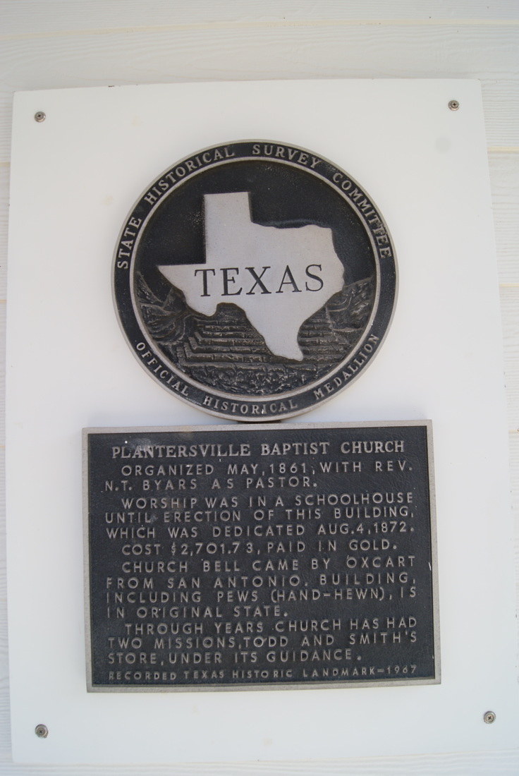
Marker Text: Organized May, 1861, with Rev. N. T. Byars as pastor.
Worship was in a schoolhouse until erection of this building, which was dedicated Aug. 4, 1872. Cost $2,701.73, paid in gold. Church bell came by oxcart from San Antonio. Building, including pews (hand-hewn), is in original state. Through years church has had two missions, Todd and Smith's Store, under its guidance. (1967) Marker No: 8610
Medallion & plate
Geographic: 30.331825, -95.860687
Location: from the intersection of SH 105 and FM 1774 in Plantersville take FM 1774 south approximately .5 mile.
|