• Alfred M. Hallmark
  • First Baptist Church of Zephyr
  • Military Road
  • Belle Plaine Cemetery
  • Community of Fodice
  • Providence Church and Cemetery
  • Packsaddle Mountain
  • No. 59 Old San Antonio Road
  • Anderson County in the Civil War
  • Smithfield Baptist Church
  • Phair Cemetery
  • New Page
  • New Page
  • New Page
TEXAS HISTORICAL MARKERS

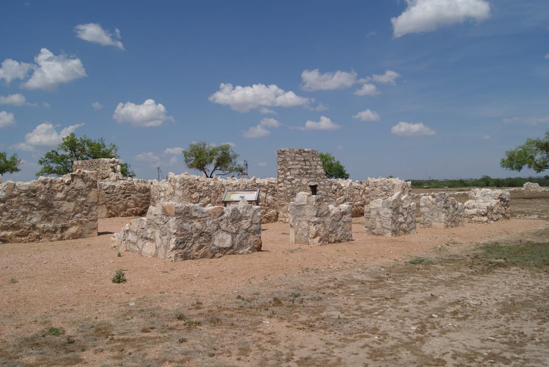
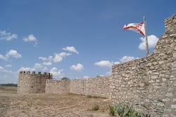
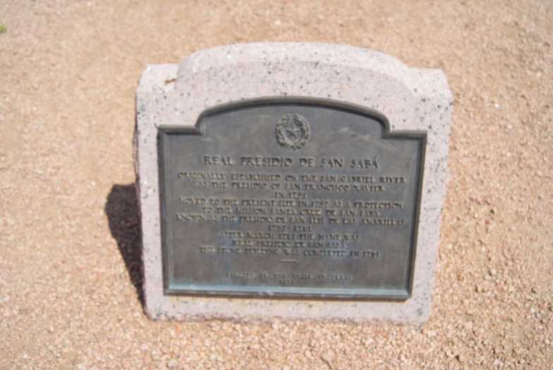
Real Presidio de San Saba

M
E
N
A
R
D

C
O
U
N
T
Y
Marker Text: Originally established on the San Gabriel River as the Presidio of San Francisco Xavier in 1751 moved to the present site in 1757 as a protection to the Mission Santa Cruz de San Saba known as the Presidio de San Luis de Las Amarillas 1757-1761. After March 1761 the name was real Presidio de San Saba the stone building was completed in 1761. (1936) 
Picture
Marker No: 4212
Geographic: 30.922291,-99.802658
1936 Pink Granite Centennial Marker 
National Register of Historic Places
Location: 1.5 miles west of Menard off US 190 about .5 mile (on grounds of Menard Country Club)
Picture
Picture
Proudly powered by Weebly
  • Alfred M. Hallmark
  • First Baptist Church of Zephyr
  • Military Road
  • Belle Plaine Cemetery
  • Community of Fodice
  • Providence Church and Cemetery
  • Packsaddle Mountain
  • No. 59 Old San Antonio Road
  • Anderson County in the Civil War
  • Smithfield Baptist Church
  • Phair Cemetery
  • New Page
  • New Page
  • New Page