• Alfred M. Hallmark
  • First Baptist Church of Zephyr
  • Military Road
  • Belle Plaine Cemetery
  • Community of Fodice
  • Providence Church and Cemetery
  • Packsaddle Mountain
  • No. 59 Old San Antonio Road
  • Anderson County in the Civil War
  • Smithfield Baptist Church
  • Phair Cemetery
  • New Page
  • New Page
  • New Page
TEXAS HISTORICAL MARKERS

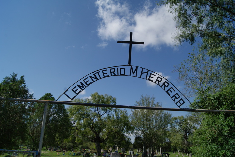
Ruiz-Herrera Cemetery

B
E
X
A
R

C
O
U
N
T
Y
Marker Text: Started in 1840's still used by founding families.           Graves include those of Texas patriots Francisco Antonio Ruiz, 1836 acting mayor, whos father and uncle signed declaration in Independence; and Blas Herrera, who alerted the Alamo defenders to Santa Anna's approach. (1967) 
Marker No: 4387
Aluminum 14 x 24 Subject Marker
Geographic; 29.272242, -98.610680
Location: end of Quesenberry Road. There is cemetery sign on Sommerset Road and Quesenberry Road on the right side of the fence post. You have to watch out where the road curves to the left. The cemetery is behind a home. The part of the country road that takes you to the cemetery is very bumpy, cannot drive a small car thru this road. Going north on 135, take exit 144 to Fisher Road make right turn on Fisher Road. When you get to the first traffic turn right and that is Sommerset Road. Quesenberry Road is about one quarter mile on the left. This is the sign on the fence post pointing to the cemetery. If you follow the road it will lead to the cemetery.
Picture
Picture
Proudly powered by Weebly
  • Alfred M. Hallmark
  • First Baptist Church of Zephyr
  • Military Road
  • Belle Plaine Cemetery
  • Community of Fodice
  • Providence Church and Cemetery
  • Packsaddle Mountain
  • No. 59 Old San Antonio Road
  • Anderson County in the Civil War
  • Smithfield Baptist Church
  • Phair Cemetery
  • New Page
  • New Page
  • New Page