San Patricio County
|
S
A N P A T R I C I O C O U N T Y |
Marker Text: Spanish exploration and activity in the area dated from 1519, through 1821, when Mexico won its independence. In 1828, James McGloin and John McMullen received a Mexican land grant here, to which they brought irish colonists.
County was created in 1836; named for St. Patrick, Patron Saint of Ireland. Organized in 1837, with San Patricio as county seat. Southern boundary of the county, the Nueces River, played a major role in events leading to the war with Mexico (1846-48), including the crossing of the river by Zachary Taylor's Army, which had travelled across the county. County seat was moved to Sinton in 1893. (1936, 1973) 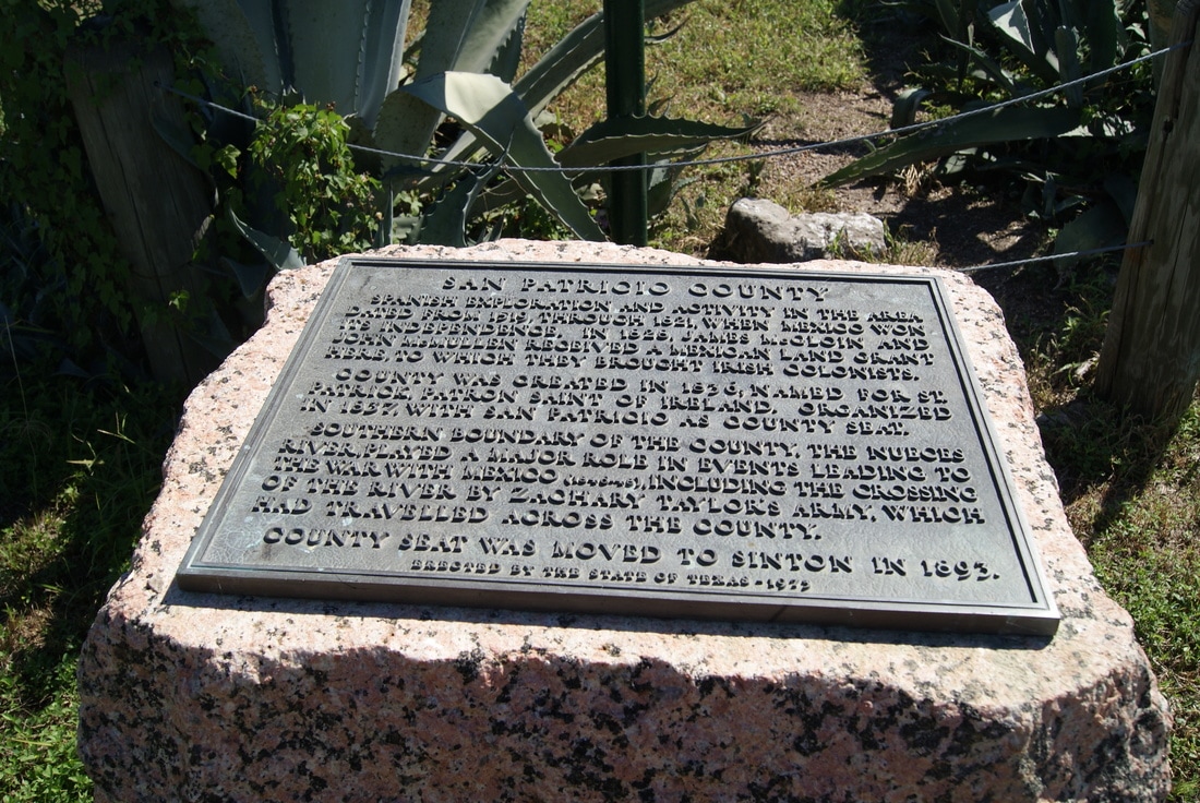
|
Marker No: 4549
1936 Centennial Pink Granite County Marker
Geographic: 27.951836,-97.772926
Location: Old courthouse grounds, FM 666, San Patricio