San Saba County
|
S
A N S A B A C O U N T Y |
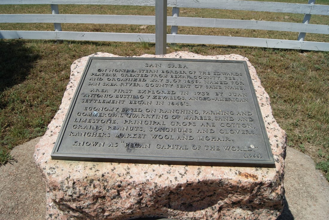
Marker Text: On northeastern border of the Edwards Plateau. created from Bexar County, Feb. 1, and organized May 3, of 1856. Named for San Saba River. County seat of same name.
Area first explored in 1732 by Juan Antonio Bustilio Y Zevallos. Anglo-American settlement began in 1840s. Economy based on ranching, farming and commercial quarrying of marble, sand and limestone. Principal crops are cotton, grains, peanuts, sorghums and clovers. Ranchers market wool and mohair. Known as "Pecan Capital of the World". (1936) (1966) Original Plate: Formed from Bexar County; created February 1, 1856; organized May 3, 1856. The river traversing the region, the mission erected near by in 1757, and later the county and county seat were given the name of an early saint, whose name in Spanish is Saba. (1936)
|
|
Marker No: 4554
Geographic: 31.195707, -98.709282
|
Pink Granite 1936 Centennial County Marker
Location: From San Saba, take 190 East .2 mile
|