Stonewall Community Cemetery
|
G
I L L E S P I E C O U N T Y |
Marker No: 12866
Texas Historical Cemetery Marker
Location: Cemetery Road, south of US 290, Stonewall
Geographic: 30.233418, -98.659515
|
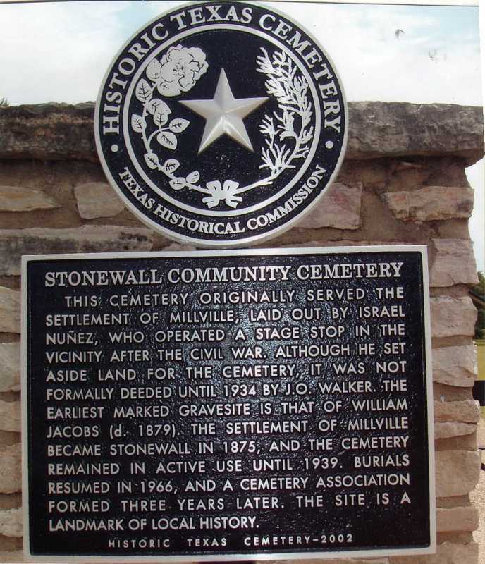
Marker Text: This cemetery originally served the settlement of Millville, laid out by Israel Nuñez, who operated a stage stop in the vicinity after the Civil War. Although he set aside land for the cemetery, it was not formally deeded until 1934 by J.O. Walker. The earliest marked gravesite is that of William Jacobs (d. 1879). The settlement of Millville became Stonewall in 1875, and the cemetery remained in active use until 1939. Burials resumed in 1966, and a cemetery association formed three years later. The site is a landmark of local history. (2002)
|