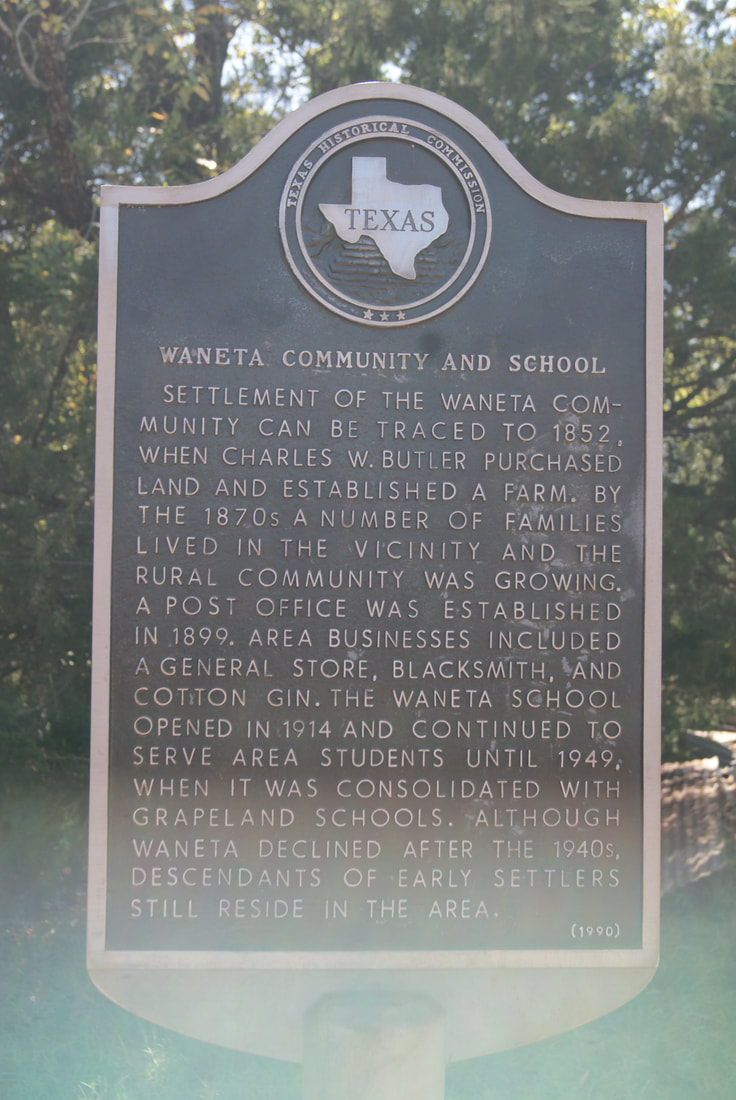
Waneta Community and School
|
H
O U S T O N C O U N T Y |
Geographic: 31.568344,-95.350075
Location: nine miles northeast of Grapeland on FM 228, then .5 mile east on CR 1475 to intersection with Cr 1750
|
Marker Text: Settlement of the Waneta Community can be traced to 1852, when Charles W. Butler purchased land and established a farm. By the 1870s a number of families lived in the vicinity and the rural community was growing. A post office was established in 1899. Area businesses included a general store, blacksmith, and cotton gin. The Waneta School opened in 1914 and continued to serve area students until 1949, when it was consolidated with Grapeland Schools. Although Waneta declined after the 1940s, descendants of early settlers still reside in the area. (1990)
Marker No: 11068
Aluminum 18 x 28 Subject Marker
|