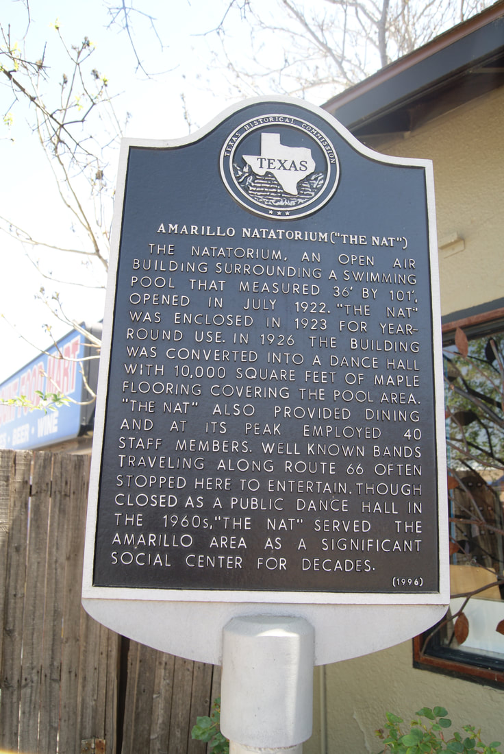
Amarillo Natatorium ("The Nat")
Marker No: 146
Aluminum 18 x 28 Subject Marker
Geographic: 35.211182, -101.866592
Location: 2705 SW 6th, Amarillo
|
|
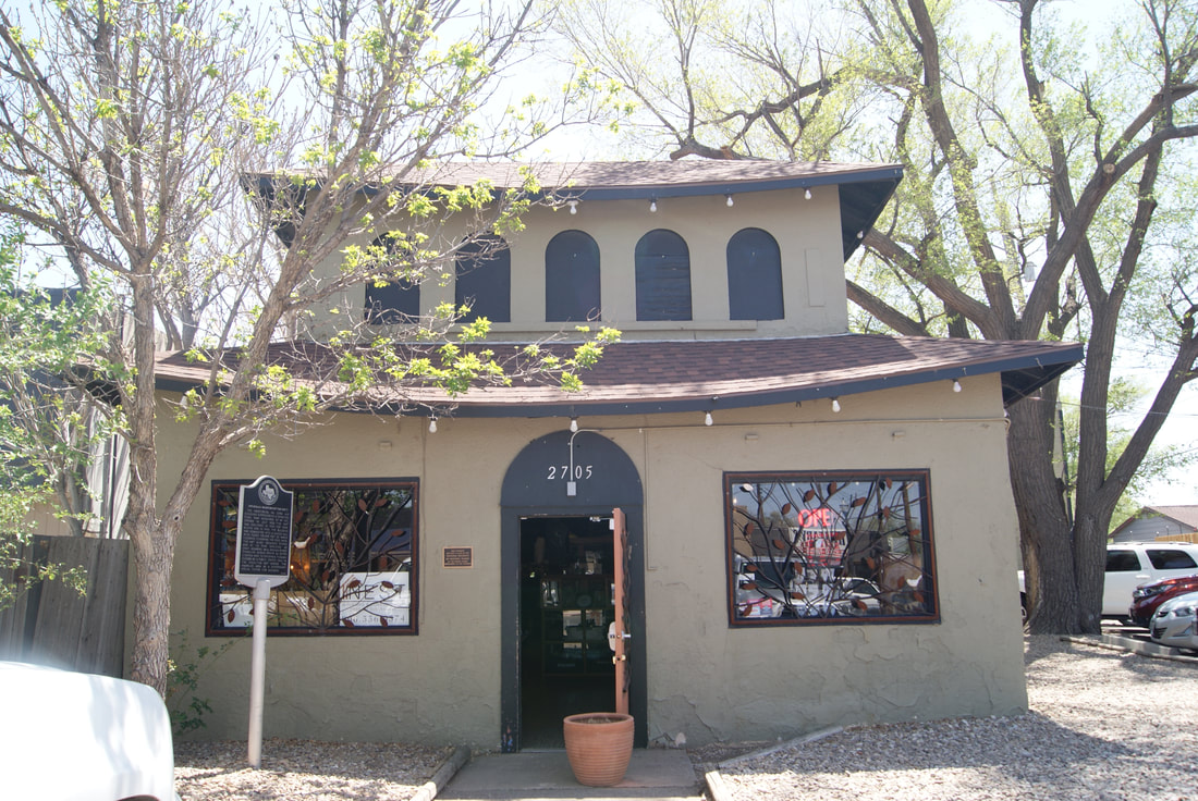
Marker No: 146
Aluminum 18 x 28 Subject Marker
Geographic: 35.211182, -101.866592
Location: 2705 SW 6th, Amarillo
|
|