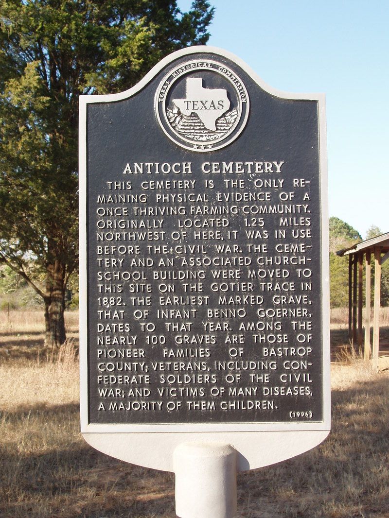
Antioch Cemetery
|
B
A S T R O P C O U N T Y |
Marker No: 9148
Aluminum 18 x 28 Subject Marker
|
Marker Text: This cemetery is the only remaining physical evidence of a once thriving farming community. Originally located 1.25 miles northwest of here, it was in use before the Civil War. The cemetery and an associated church-school building were moved to this site on the Gotier Trace in 1882. The earliest marked grave, that of infant Benno Goerner, dates to that year. Among the nearly 100 graves are those of pioneer families of Bastrop County; veterans, including Confederate soldiers of the Civil War; and victims of many diseases, a majority of them children. (1996)
Geographic: 30.10949, -97.18283
Location: 6 miles east of Bastrop, 3 miles north on CR 154 at intersection with CR 146
|