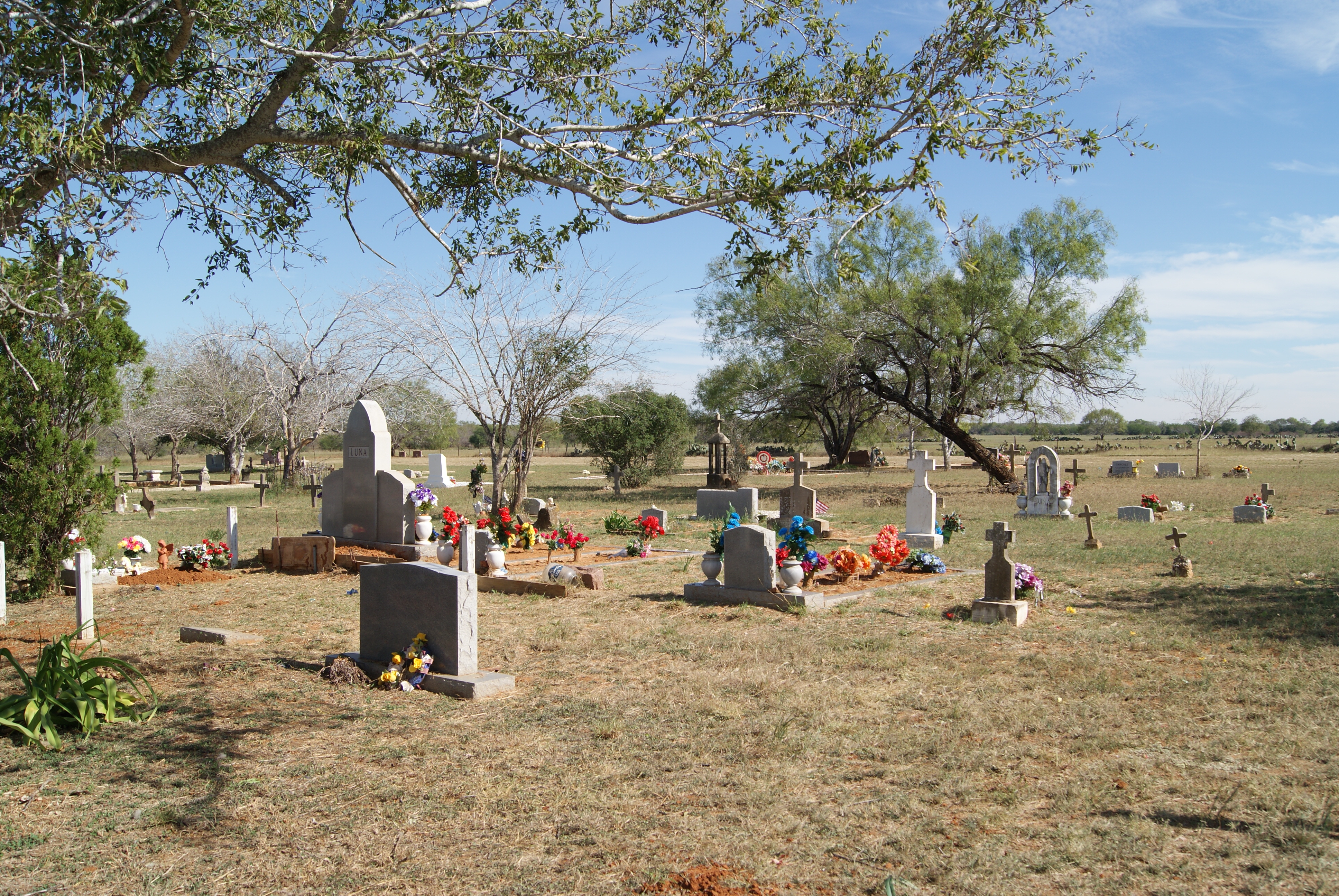
• Alfred M. Hallmark
  • First Baptist Church of Zephyr
  • Military Road
  • Belle Plaine Cemetery
  • Community of Fodice
  • Providence Church and Cemetery
  • Packsaddle Mountain
  • No. 59 Old San Antonio Road
  • Anderson County in the Civil War
  • Smithfield Baptist Church
  • Phair Cemetery
  • New Page
  • New Page
  • New Page
TEXAS HISTORICAL MARKERS

​Chilipitin Cemetery

A
T
A
S
C
O
S
A

C
O
U
N
T
​Y
Marker Text: Early area settlers Dario and Manuelita Douglas Tober acquired land here in 1877 and later set aside this site for a family cemetery. The oldest marked grave, that of teenager Nieves Douglas Tober, dates to 1903. The Tober family deeded the original tract to the Chilipitin Cemetery Association in 1910, and the site has been enlarged and used as a burial ground for the Miguel community and surrounding areas of Atascosa and Frio counties. The cemetery features curbed plots, highly decorated graves, religious iconography and an arched entryway in a South Texas prairie setting. (2005)
Marker No: 13619
Texas Historical Cemetery Marker 
Geographic: 28.862411, -98.791382
Picture
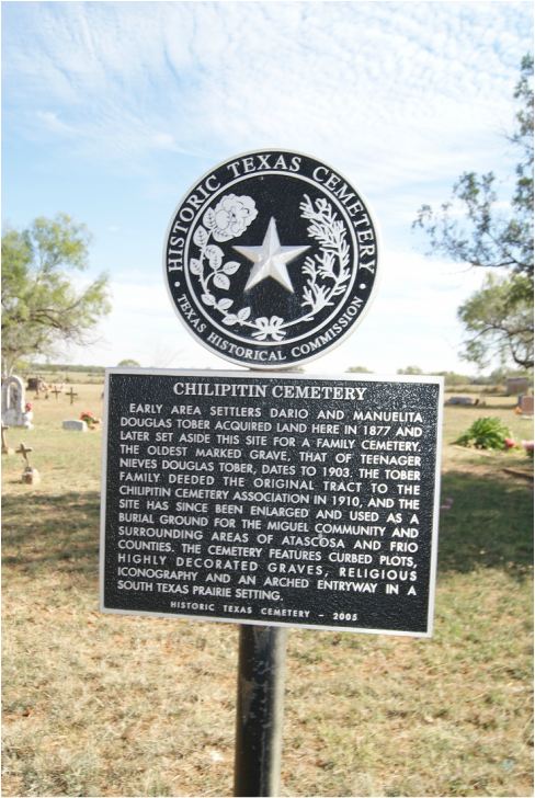
Location: CR 315 east of FM 140, Charlotte
Picture
Proudly powered by Weebly
  • Alfred M. Hallmark
  • First Baptist Church of Zephyr
  • Military Road
  • Belle Plaine Cemetery
  • Community of Fodice
  • Providence Church and Cemetery
  • Packsaddle Mountain
  • No. 59 Old San Antonio Road
  • Anderson County in the Civil War
  • Smithfield Baptist Church
  • Phair Cemetery
  • New Page
  • New Page
  • New Page