• Alfred M. Hallmark
  • First Baptist Church of Zephyr
  • Military Road
  • Belle Plaine Cemetery
  • Community of Fodice
  • Providence Church and Cemetery
  • Packsaddle Mountain
  • No. 59 Old San Antonio Road
  • Anderson County in the Civil War
  • Smithfield Baptist Church
  • Phair Cemetery
  • New Page
  • New Page
  • New Page
TEXAS HISTORICAL MARKERS

Eden 

C
O
N
C
H
O

C
O
U
N
T
​Y
Marker Text: ​Founded 1882. Incorporated 1910. Named for Frederick Eden, native of England and pioneer ranchman on whose land the town was located, and who donated land for this public square.
​       Farming and ranching area. Wool and mohair marketing center. Elevation 2,052 feet. Location of Concho County Hospital. (1964)
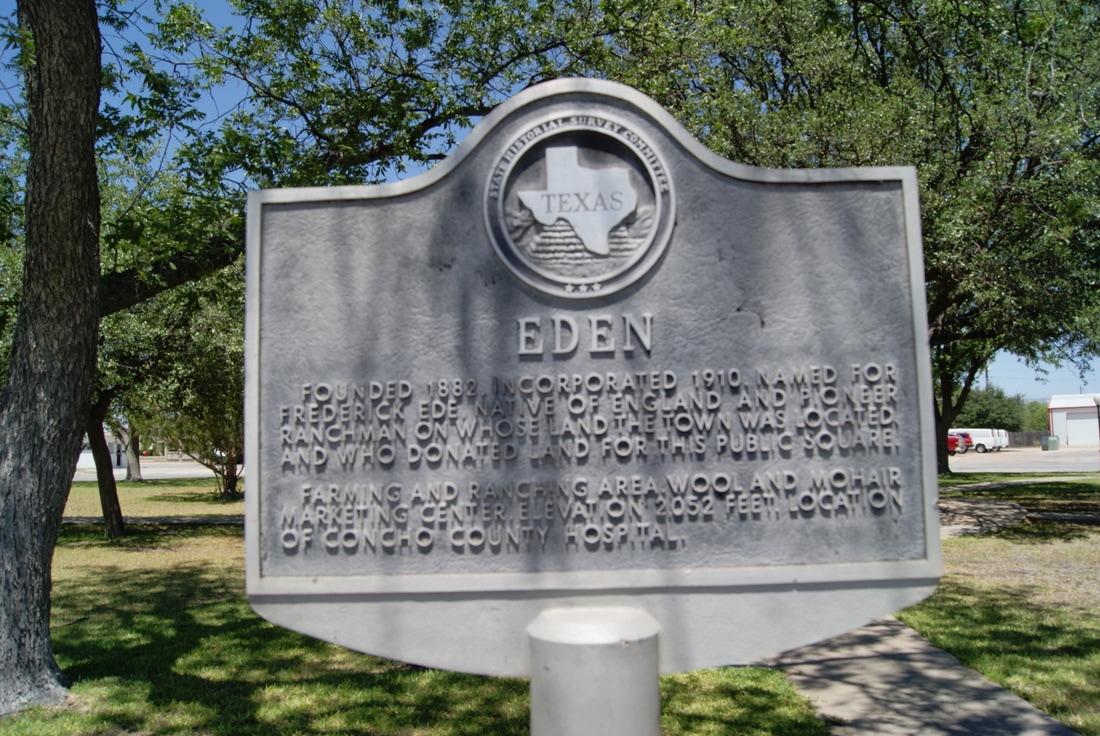
Picture
Marker No: 1387
Aluminum 20 x 20 Subject Marker
Geographic: 31:214598.-99842636
Location: ​Town square, on US 83, 1 block off intersection of US 83 and US 87
Proudly powered by Weebly
  • Alfred M. Hallmark
  • First Baptist Church of Zephyr
  • Military Road
  • Belle Plaine Cemetery
  • Community of Fodice
  • Providence Church and Cemetery
  • Packsaddle Mountain
  • No. 59 Old San Antonio Road
  • Anderson County in the Civil War
  • Smithfield Baptist Church
  • Phair Cemetery
  • New Page
  • New Page
  • New Page