First Artesian Well
|
L
A S A L L E C O U N T Y |
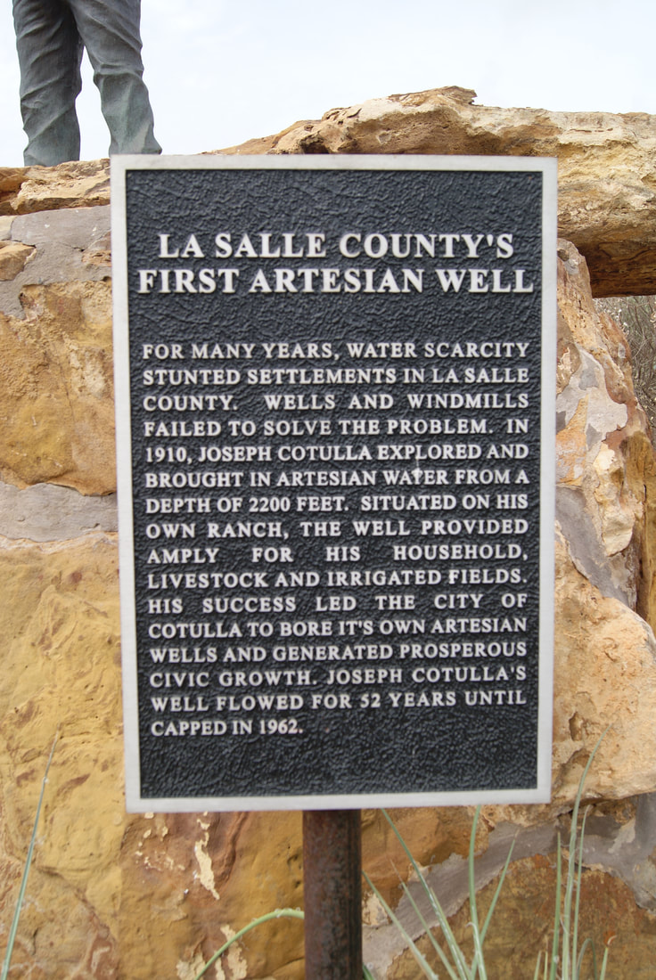
Marker Text: For many years, water scarcity stunted settlements in La Salle County. Wells and windmills failed to solve the problem. In 1910 at this site, Joseph Cotulla (1844-1923) explored and brought in artesian water from a depth of 2200 feet. Situated on his own ranch, the well provided amply for his household, livestock, and irrigated fields. His success led the city of Cotulla to bore its own artesian wells and generate prosperous civic growth. Joseph Cotulla's well at this site flowed for 52 years, until capped in 1962. (1978)
Marker No: 8140
Aluminum 18 x 28 Subject Marker
Geographic:
|
Location: The above marker is in City Park. The original marker was where the well is located, I don't know if the original marker is still in place.
|