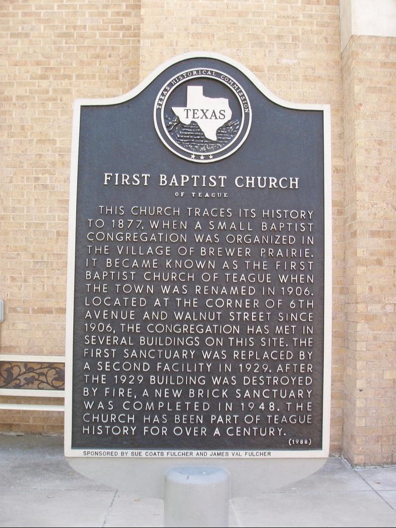
First Baptist Church of Teague
|
F
R E E S T O N E C O U N T Y |
Marker No: 9874
Aluminum 18 x 28 Subject Marker
Geographic: 31.627855, -96.280731
|
Marker Text: This church traces its history to 1877, when a small Baptist congregation was organized in the village of Brewer Prairie. It became known as the First Baptist Church of Teague when the town was renamed in 1906. Located at the corner of 6th Avenue and Walnut Street since 1906, the congregation has met in several buildings on this site. The first sanctuary was replaced by a second facility in 1929. After the 1929 building was destroyed by fire, a new brick sanctuary was completed in 1948. The church has been part of Teague history for over a century. (1988)
Location: 608 Walnut Street, Teague
|