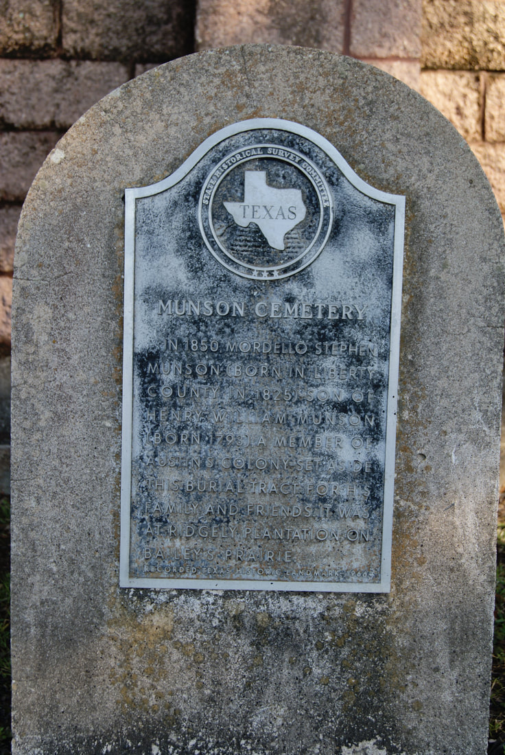
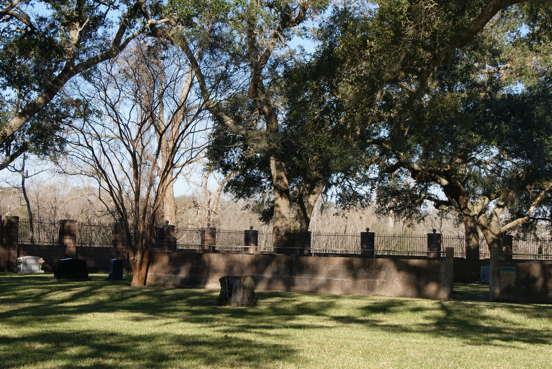
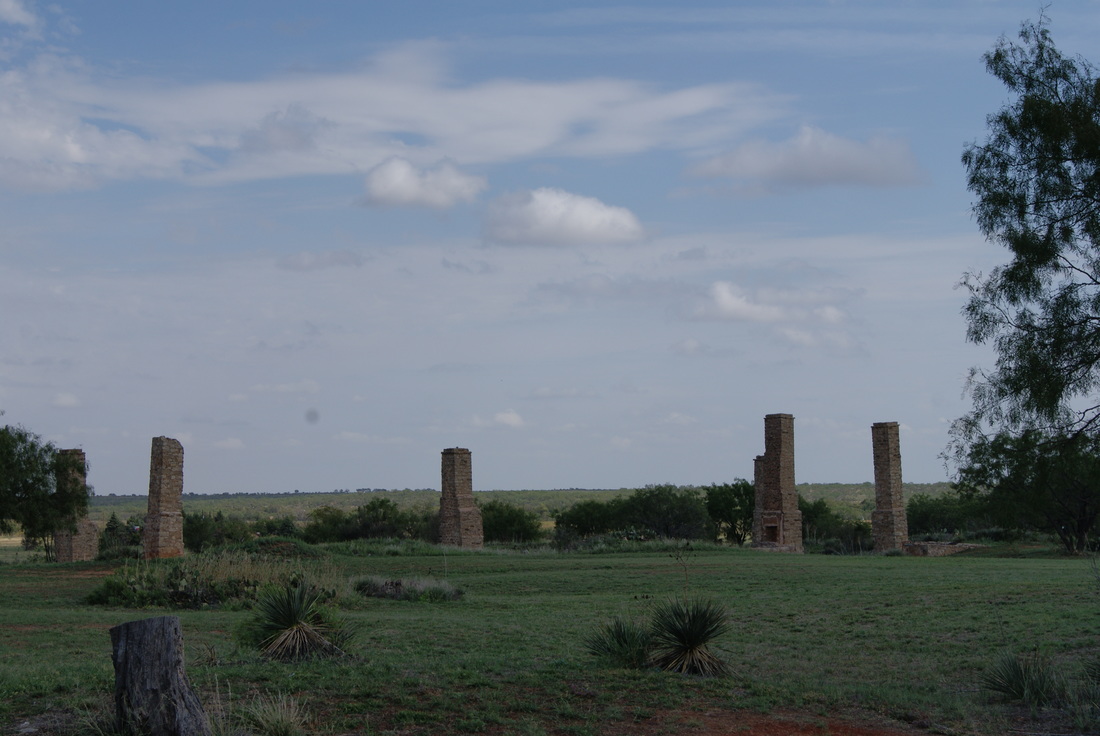
Fort Phantom Hill
|
J
O N E S C O U N T Y |
Marker Text: Established November 14, 1851, as unit in chain of forts from Red River to Rio Grande, to defend frontier settlers and west-bound 49ers. Officially "Post on Clear Fork of the Brazos", everyday name became "Phantom Hill," either from prevalent mirages or sighting of ghostly Indian in moonlight. Abandoned by U. S. Army on April 6, 1854, fort served in 1858-61 as stage stand for Southern Overland Mail. In 1871-72, the army again used this as a sub-post of Fort Griffin, 40 miles northeast. The adjacent village was temporary county seat when Jones County was organized in 1881. (1936)
Marker No: 2004
1936 Pink Granite Bronze Plaque Centennial Marker
National Register of Historic Places
|
Geographic: 32.642685, -99.679688
Location: from Anson, take US 180 east about 10 miles to FM 600, then take FM 600 south about 8.5 miles to fort ruins
|
|
|