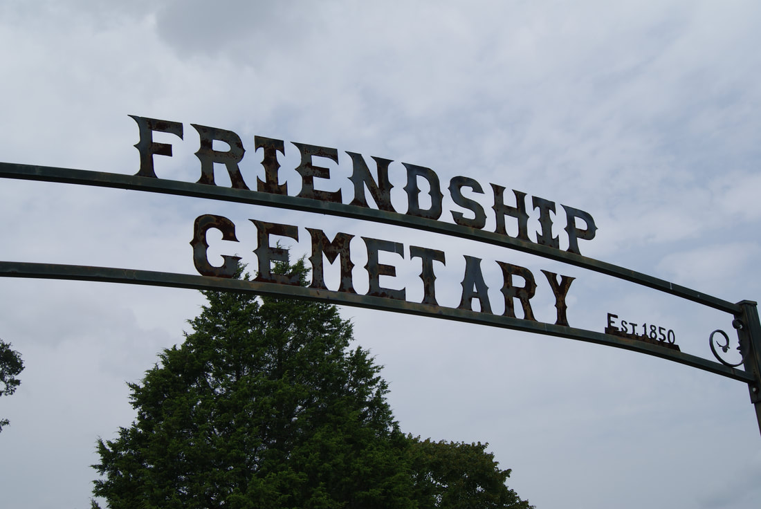
Friendship Cemetery
|
Marker Text: This 9.7-acre cemetery is part of a 350-acre land patent granted to Joseph Henson in 1850. The year that he first set it aside for burials is not known as many of the earlier graves are marked only by red sandstone rocks without dates. The earliest dated marker is the 1870 gravestone of Josa Hood (1808-1870). Vandals, wildlife and livestock have taken their toll on this burial ground, but descendants and relatives of the citizens laid to rest here continue to make improvements and care for this site that remains a chronicle of the pioneers and families that settles and developed this corner of Leon County. (2001)
Marker No: 17416
Texas Historic Cemetery Marker
Geographic: 31.34235, -96.28252
Location: approximately 10 miles west/northwest of Jewett, .06 of a mile west on CR 3671 which runs off of FM 1146 near its intersection with FM 1469.
|