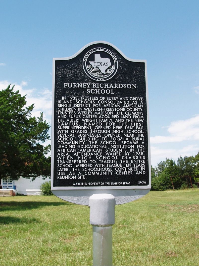
Furney Richardson School
|
F
R E E S T O N E C O U N T Y |
Marker No: 14966
Aluminium 18 x 28 Subject Marker
Geographic: 31.628437, -96.340256
Location: 4 miles west of Teague on FM 1365 at intersection with CR 890
|
Marker Text: In 1933, trustees of Busby and Grove Island Schools consolidated as a single district for African American children in western Freestone County. Trustees Wesley Madison, J.H. Clemons and Rufus Carter acquired land from the Albert Wright Family, and the new campus, named for the first superintendent, opened here that fall with grades through high school. Several businesses opened here that fall with grades through high school. Several businesses opened near the school building to form a rural community. The school became a leading educational institution for African American students in the area. Attendance waned by 1958 when high school classes transferred to Teague; the entire school merged with Teague ten years later. The schoolhouse continued in use as a community center and reunion site. (2008)
|