Goliad County
|
G
O L I A D C O U N T Y |
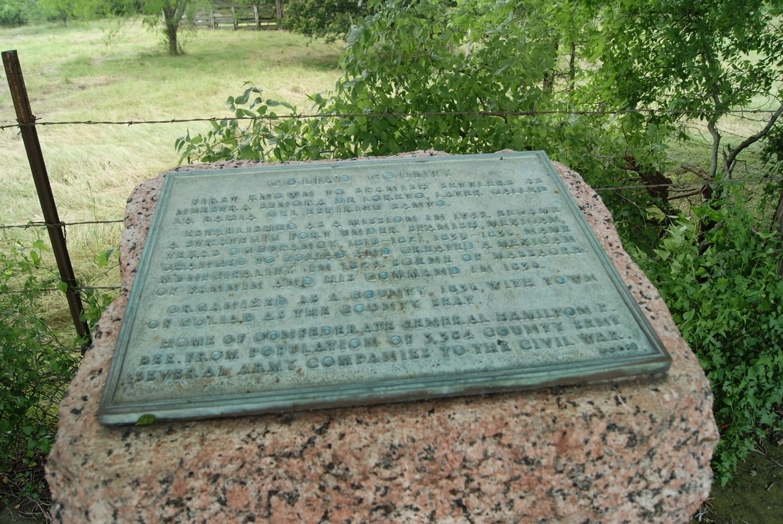
Marker Text: First known to Spanish settlers as Nuestra Senora de Loreto, later called La Bahia del Espiritu Santo.
Established as a mission in 1749. Became a strategic fort under Spanish, Mexican, Texas occupancy, 1810 - 1821, 1835 - 1836. Name changed to Goliad and created a Mexican municipality in 1829. Scene of massacre of Fannin and his command in 1836. Organized as a county, 1836, with town of Goliad as the county seat. Home of Confederate General Hamilton P. Bee. From population of 3,384 county sent several army companies to the Civil War. (1936) Marker No: 2203
1936 Pink Granite Centennial County Marker
Geographic: 28.645479,-97.440117
|
Location: from Goliad, take US 59 west about 4.5 miles to roadside park, north side of road.