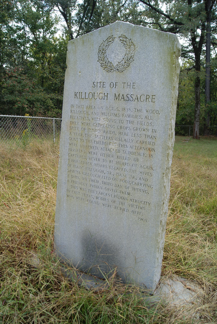
• Alfred M. Hallmark
  • First Baptist Church of Zephyr
  • Military Road
  • Belle Plaine Cemetery
  • Community of Fodice
  • Providence Church and Cemetery
  • Packsaddle Mountain
  • No. 59 Old San Antonio Road
  • Anderson County in the Civil War
  • Smithfield Baptist Church
  • Phair Cemetery
  • New Page
  • New Page
  • New Page
TEXAS HISTORICAL MARKERS

​Site of the
​Killough Massacre

​C
H
E
R
O
K
E
E

C
O
U
N
T
​Y
Picture
Marker No: 6975
Gray Granite with etched Star & Wreath
Marker Text: ​In this area, on October 5, 1838, the Killough, Wood and Williams families were attacked by hostile Indians and Mexicans: 18 were either killed or carried away; 8 escaped on horseback; 3 women with a baby fled on foot and were saved on third day by a friendly Indian. Was biggest Indian depredation of East Texas. Bodies of the victims found were buried here. (1965) 
Geographic: 32.054798,-95.342834
Location: ​7 miles northwest of Jacksonville on US 69, north to FM 855 then southeast on CR 3405 to monument site on CR 3411
Proudly powered by Weebly
  • Alfred M. Hallmark
  • First Baptist Church of Zephyr
  • Military Road
  • Belle Plaine Cemetery
  • Community of Fodice
  • Providence Church and Cemetery
  • Packsaddle Mountain
  • No. 59 Old San Antonio Road
  • Anderson County in the Civil War
  • Smithfield Baptist Church
  • Phair Cemetery
  • New Page
  • New Page
  • New Page