• Alfred M. Hallmark
  • First Baptist Church of Zephyr
  • Military Road
  • Belle Plaine Cemetery
  • Community of Fodice
  • Providence Church and Cemetery
  • Packsaddle Mountain
  • No. 59 Old San Antonio Road
  • Anderson County in the Civil War
  • Phair Cemetery
  • New Page
  • New Page
  • New Page
  • New Page
  • New Page
  • New Page
  • New Page
  • New Page
  • New Page
  • New Page
  • New Page
  • New Page
  • New Page
  • New Page
  • New Page
  • New Page
  • New Page
  • New Page
TEXAS HISTORICAL MARKERS

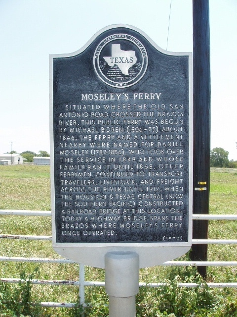
​Mosley's Ferry

B
U
R
L
E
S
O
​N

C
O
U
N
T
​Y
Marker Text: ​Situated where the old San Antonio Road crossed the Brazos River, this public ferry was begun by Michael Boren (1806-75) about 1846. The ferry and a settlement nearby were named for Daniel Moseley (1787-1856), who took over the service in 1849 and whose family ran it until 1868. Other ferrymen continued to transport travelers, livestock, and freight across the river until 1912, when the Houston & Texas Central (now the Southern Pacific) constructed a railroad bridge at this location. Today a highway bridge spans the Brazos where Moseley's Ferry once operated. (1973) 
Marker No: 7571
Aluminum 18 x 28 Subject Marker
Geographic: 30.624146,-96.545296
Picture
Location: from Caldwell, take SH 21 about 10 miles northeast, marker is between FM 50 and Brazos River Bridge on east side of road
Proudly powered by Weebly
  • Alfred M. Hallmark
  • First Baptist Church of Zephyr
  • Military Road
  • Belle Plaine Cemetery
  • Community of Fodice
  • Providence Church and Cemetery
  • Packsaddle Mountain
  • No. 59 Old San Antonio Road
  • Anderson County in the Civil War
  • Phair Cemetery
  • New Page
  • New Page
  • New Page
  • New Page
  • New Page
  • New Page
  • New Page
  • New Page
  • New Page
  • New Page
  • New Page
  • New Page
  • New Page
  • New Page
  • New Page
  • New Page
  • New Page
  • New Page