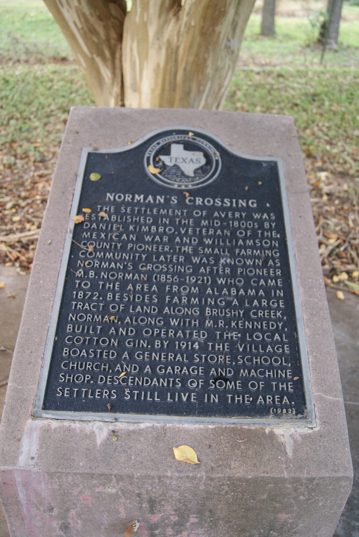
Norman's Crossing
|
W
I L L I A M S O N C O U N T Y |
|
Marker Text: The settlement of Avery was established in the mid-1800s by Daniel Kimbro, veteran of the Mexican War and Williamson County pioneer. The small farming community later was known as Norman's Crossing after pioneer M. B. Norman (1856-1921) who came to the area from Alabama in 1872. Besides farming a large tract of land along Brushy Creek, Norman, along with M. R. Kennedy, built and operated the local cotton gin. By 1914 the village boasted a general store, school, church, and a garage and machine shop. Descendants of some of the settler still live in the area. (1982)
Marker No: 9312
Aluminum 18 x 28 Subject Marker
Geographic: 30.494518,-97.499176
Location: 5 miles southeast, approx. 2.5 miles west of Rice's Crossing
|