Robertson County
|
R
O B E R T S O N C O U N T Y |
|
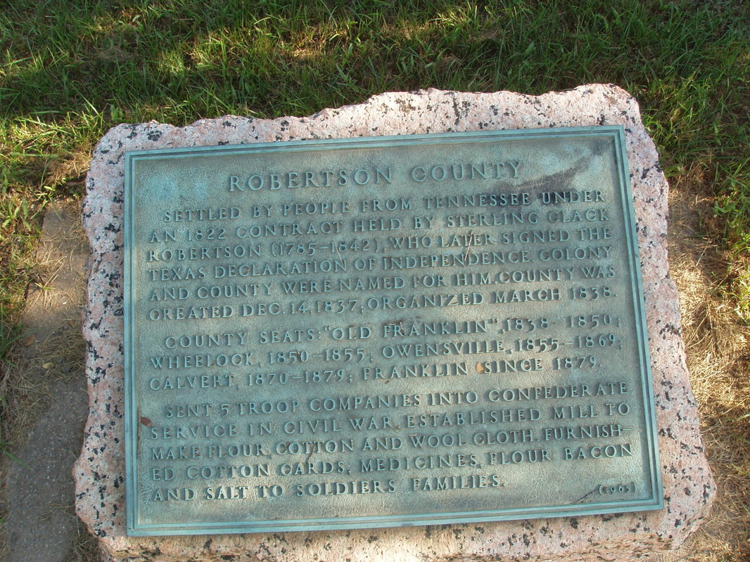
Marker Text: Settled by people from Tennessee under an 1822 contract held by Sterling Clark Robertson (1785-1842), who later signed the Texas Declaration of Independence. Colony and county were named for him. County was created Dec. 14, 1837; organized March 1838.
County seats: "Old Franklin," 1838-1850; Wheelock, 1850-1855; Owensville, 1855-1869; Calvert, 1870-1879; Franklin since 1879.
Sent 5 troop companies into Confederate service in Civil War. Established mill to make flour, cotton and wool cloth. Furnished cotton cards, medicines, flour, bacon and salt to soldiers' families. (1965)
Marker No: 10942
Pink Granite 1936 County Centennial Marker
Geographic: 31.040157,-96.463333
Location: 6.5 miles east of Franklin in roadside park