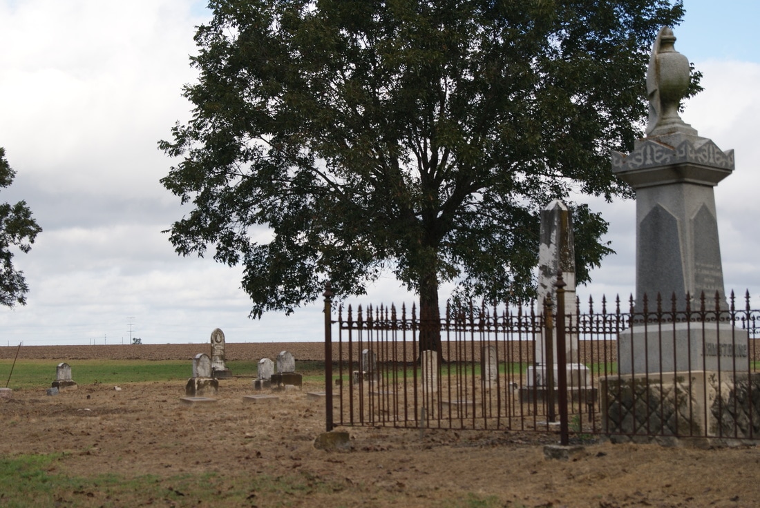
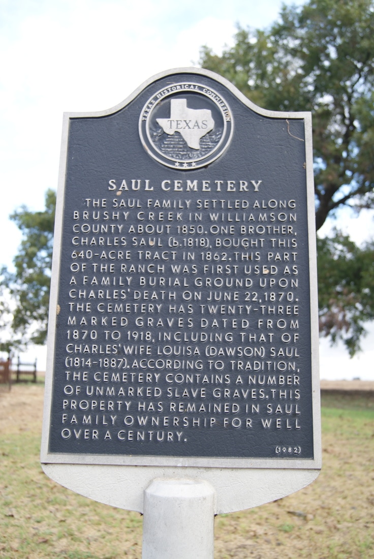
Saul Cemetery
|
W
I L L I A M S O N C O U N T Y |
|
Marker Text: The Saul family settled along Brushy Creek in Williamson County about 1850. One brother, Charles Saul (b. 1818) bought this 640-acre tract in 1862. This part of the ranch was first used as a family burial ground upon Charles' death on June 22, 1870. The cemetery has twenty-three marked graves dated from 1870 to 1918, including that of Charles' wife Louisa (Dawson) Saul (1814-1887). According to tradition, the cemetery contains a number of unmarked slave graves. This property has remained in Saul family ownership for well over a century. (1982)
Marker No: 9336
Aluminum 18x 28 Subject Marker
Geographic: 30.501530,-97.510307
Location: 1 mile west of Norman's crossing on FM 1660, 5 miles southeast of Hutto on FM 1660
|