• Alfred M. Hallmark
  • First Baptist Church of Zephyr
  • Military Road
  • Belle Plaine Cemetery
  • Community of Fodice
  • Providence Church and Cemetery
  • Packsaddle Mountain
  • No. 59 Old San Antonio Road
  • Anderson County in the Civil War
  • Smithfield Baptist Church
  • Phair Cemetery
  • New Page
  • New Page
  • New Page
TEXAS HISTORICAL MARKERS

Stonewall County

S
T
O
N
E
W
A
L
L

C
O
U
N
T
​Y
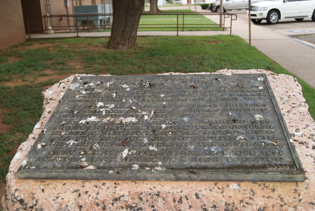
Marker Text: Explored 1541 on behalf of Spain by Francisco de Coronado. Visited by Texans early as the 1840s. Mapped by U.S. Army expedition of Capt. Randolph March, 1849. Yielded salt for use of early settlers and hunters. Was site of buffalo hunters' capital, Rath City, 1876-1879. County created in 1876; organized 1888. Named in honor of Confederate General Thomas Jonathan "Stonewall" Jackson (1824-1863), whose courage and fighting skill inspired Texas soldiers in the Civil War. First county seat, Rayner, replaced 1898 by Aspermont, named for high location. (1965)
Picture
Marker No: 5132
Pink Granite 1936 County Highway Centennial Marker
Geographic: 33.141117, -100.230034
Location: northeast corner of courthouse, US 83, Aspermont
Proudly powered by Weebly
  • Alfred M. Hallmark
  • First Baptist Church of Zephyr
  • Military Road
  • Belle Plaine Cemetery
  • Community of Fodice
  • Providence Church and Cemetery
  • Packsaddle Mountain
  • No. 59 Old San Antonio Road
  • Anderson County in the Civil War
  • Smithfield Baptist Church
  • Phair Cemetery
  • New Page
  • New Page
  • New Page