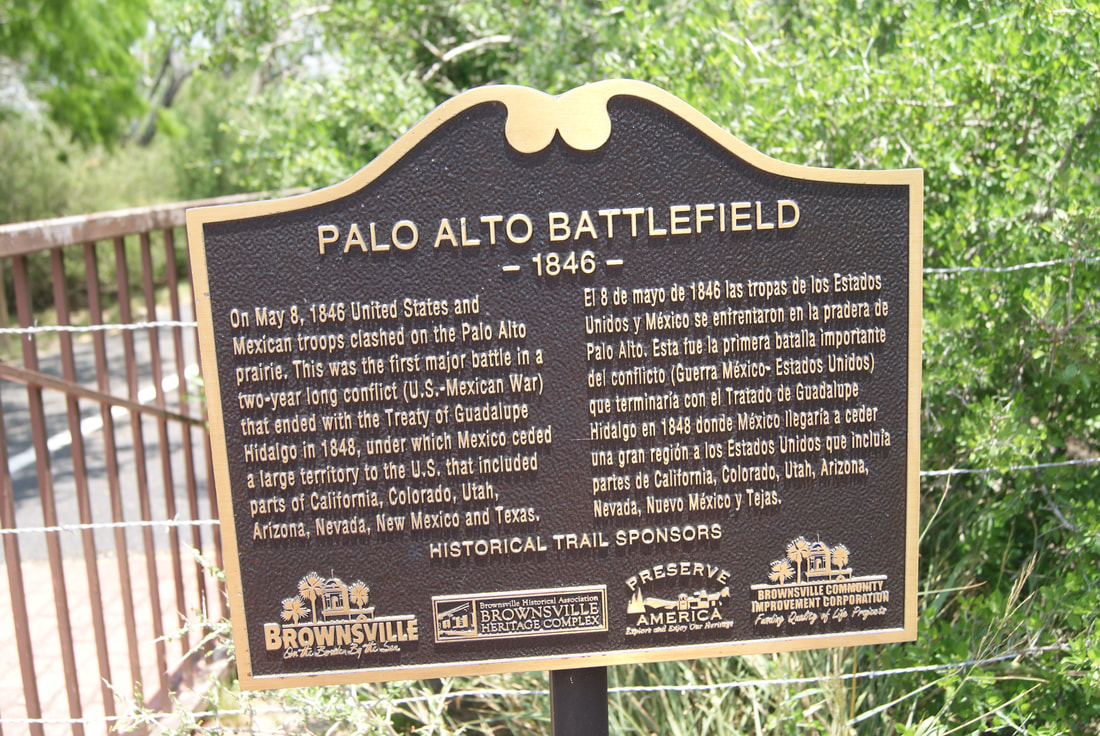
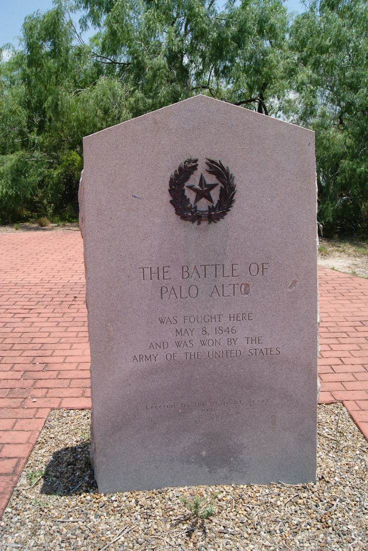
• Alfred M. Hallmark
  • First Baptist Church of Zephyr
  • Military Road
  • Belle Plaine Cemetery
  • Community of Fodice
  • Providence Church and Cemetery
  • Packsaddle Mountain
  • No. 59 Old San Antonio Road
  • Anderson County in the Civil War
  • Smithfield Baptist Church
  • Phair Cemetery
  • New Page
  • New Page
  • New Page
TEXAS HISTORICAL MARKERS

The Battle of
​Palo Alto

C
A
M
E
R
O
N

C
O
U
N
T
​Y
Picture
Marker Text: ​
Was fought here May 8, 1846 and was won by the Army of the United States. (1936)
Marker No: 5289
1936 Gray Granite Centennial Marker
National Register of Historic Places
Geographic: 26.014500, -97.481018
Location: ​Intersection of FM 1847 and TX 550/FM 511. South of entrance to Palo Alto Battlefield National Historical Park. Brownsville
Picture
Proudly powered by Weebly
  • Alfred M. Hallmark
  • First Baptist Church of Zephyr
  • Military Road
  • Belle Plaine Cemetery
  • Community of Fodice
  • Providence Church and Cemetery
  • Packsaddle Mountain
  • No. 59 Old San Antonio Road
  • Anderson County in the Civil War
  • Smithfield Baptist Church
  • Phair Cemetery
  • New Page
  • New Page
  • New Page