The Gotier Trace
|
B
A S T R O P C O U N T Y |
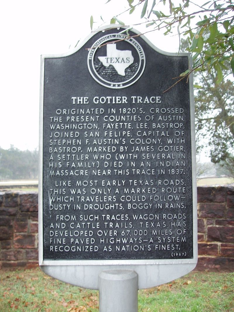
Marker Text: Originated in 1820s. Crossed the present counties of Austin, Washington, Fayette, Lee, Bastrop; joined San Felipe, capital of Stephen F. Austin's colony, with Bastrop. Marked by James Gotier, a settler who (with several in his family) died in an Indian massacre near this trace in 1837.
Like most early Texas roads, this was only a marked route which travelers could follow-- dusty in droughts, boggy in rains. From such traces, wagon roads and cattle trails, Texas has developed over 67,000 miles of fine paved highways-- a system recognized as nation's finest. (1967) Marker No: 9190
Aluminum 18 x 28 Subject Marker
|
Geographic: 30.008745,-97.159988
Location: entrance to Bastrop State Park, Loop 150 & SH 21
|