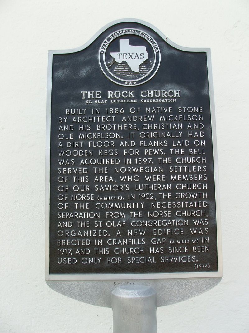
The Rock Church St. Olaf Lutheran Congregation
|
B
O S Q U E C O U N T Y |
Geographic: 31.792267, -97.773880
Location: from Cranfills Gap, take CR 4145 about 4 miles east to church and cemetery, on north side of road
|
Marker Text: Built in 1886 of native stone by architect Andrew Mickelson and his brothers, Christian and Ole Mickelson. It originally had a dirt floor and planks laid on wooden kegs for pews. The bell was acquired in 1897. The church served the Norwegian settlers of this area, who were members of Our Savior's Lutheran Church of Norse (6 miles east). In 1902, the growth of the community necessitated separation from the Norse church, and the St. Olaf congregation was organized. A new edifice was erected in Cranfills Gap (4 miles west) in 1917, and this church has since been used only for special services. (1974)
Marker No: 5416
Aluminum 18 x 28 Subject Marker
|